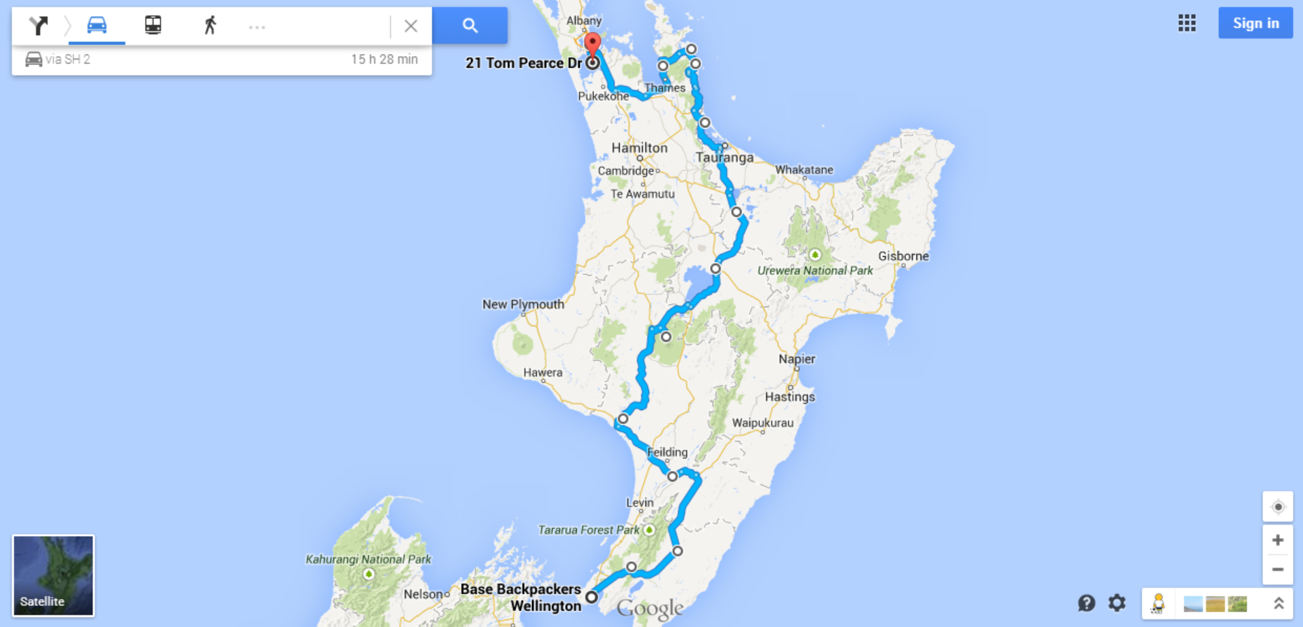
...and we're off!

taking a year of pretirement to travel the world

on may 23, 2013, we quit our jobs and began our year of "pretirement." these are some of our adventures around the world.

north island

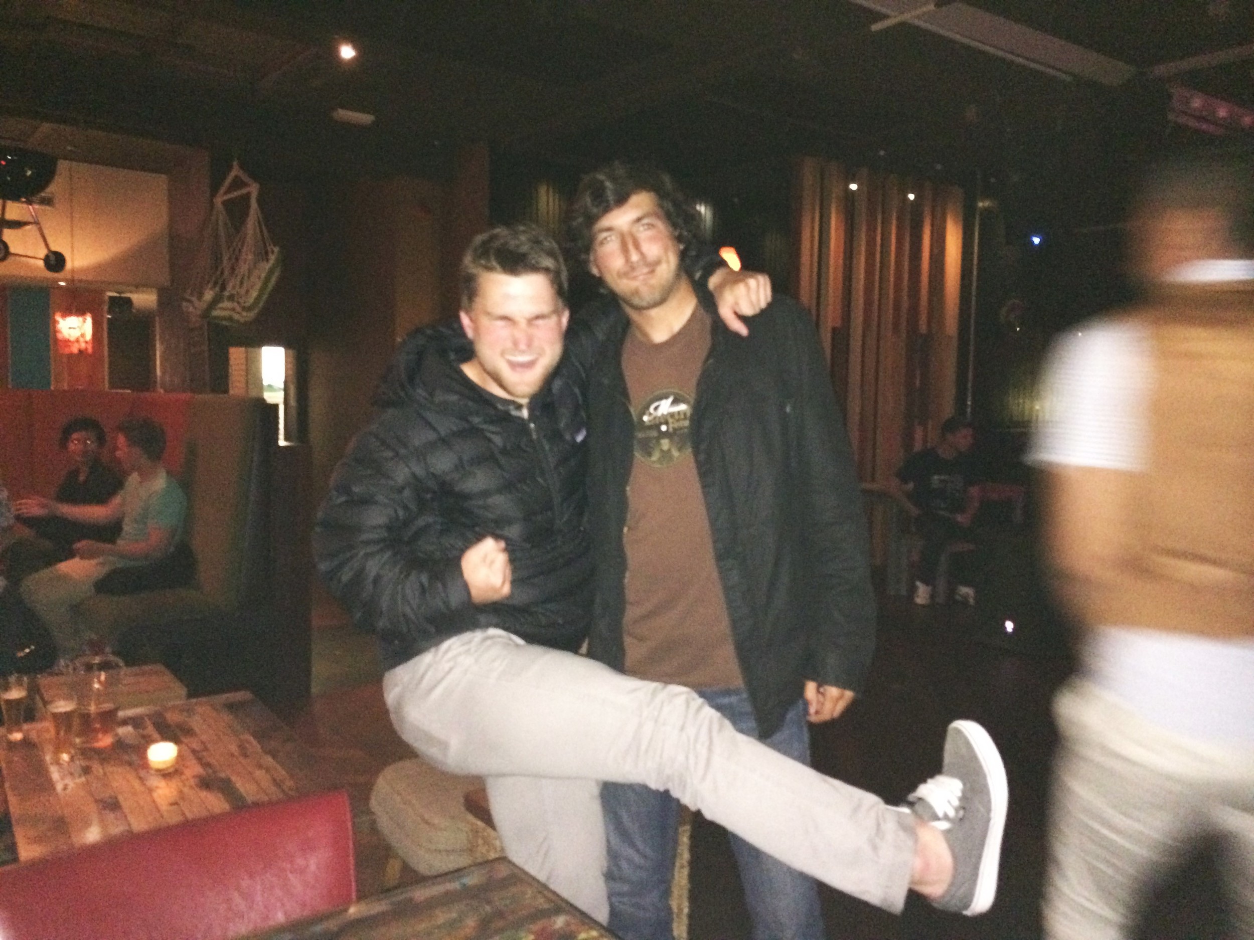
after spending two weeks admiring the south island we flew north to wellington, the capital of middle-earth – er, new zealand. this was the first stop of our last week in the country, and our plan was to explore the north island by car and make our way up to auckland for our flight back to the states. our first impression of wellington was that it was really expensive – nowhere else had we spent $150 fo one night in a hotel, let alone a HOSTEL. but as we drove into the city we noticed people in costumes roaming the streets, and they were definitely the opposite of sober. apparently we’d timed our visit to coincide with rugby sevens, which is a huge sports event here. if halloween and the superbowl had an “oops” baby, this would be it. the city’s main street was completely blocked off to accommodate the thousands of people who showed up all decked out in random costumes and creative getups. our hostel happened to be smack-dab in the middle of all the action, which provided endless people-watching and entertainment. an added bonus was that we made a new hometown friend on the other side of the world. alex’s parents’ pastor’s son had just moved to wellington, so we met up with ben and had fun bar-hopping together. 

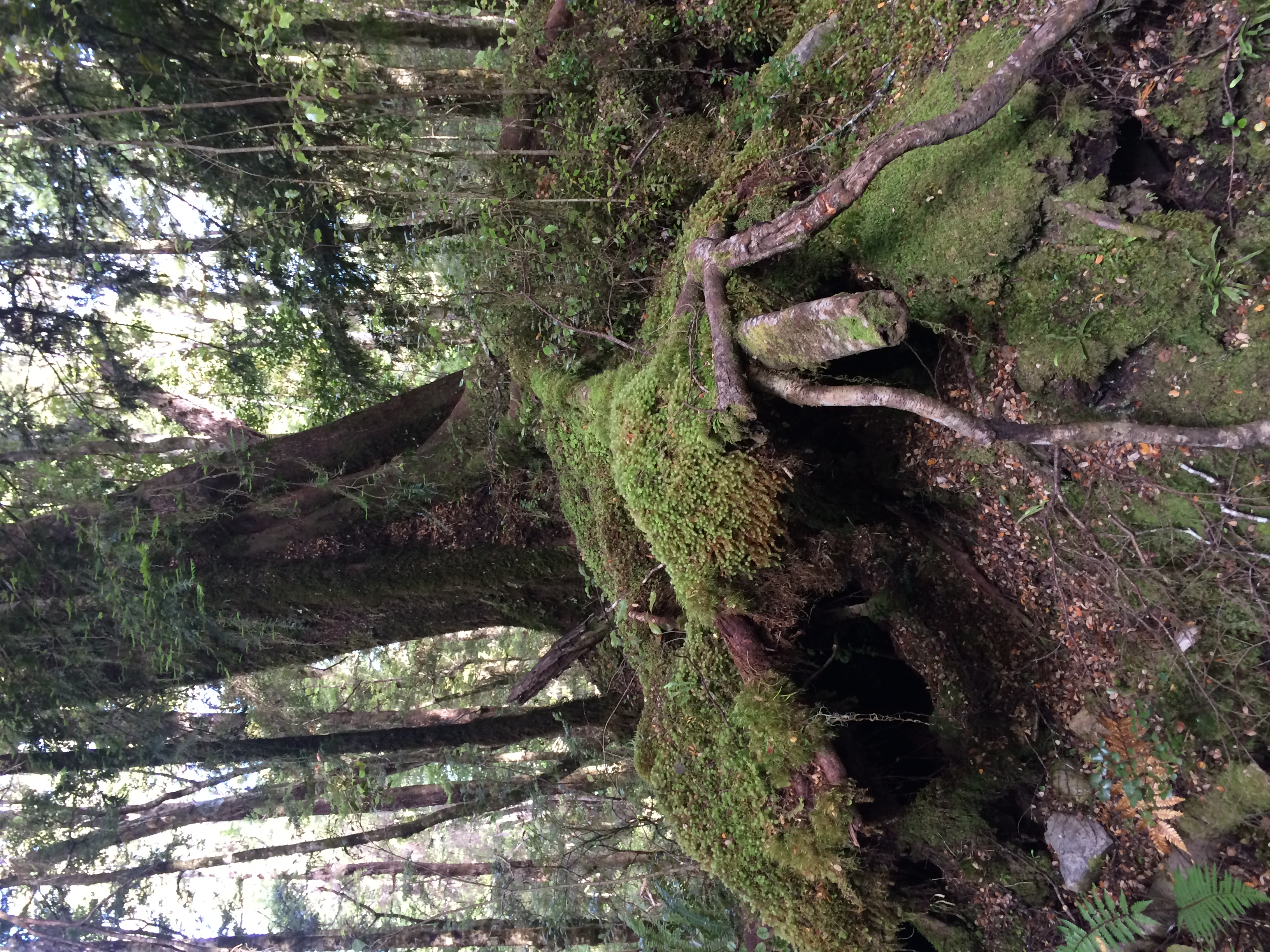
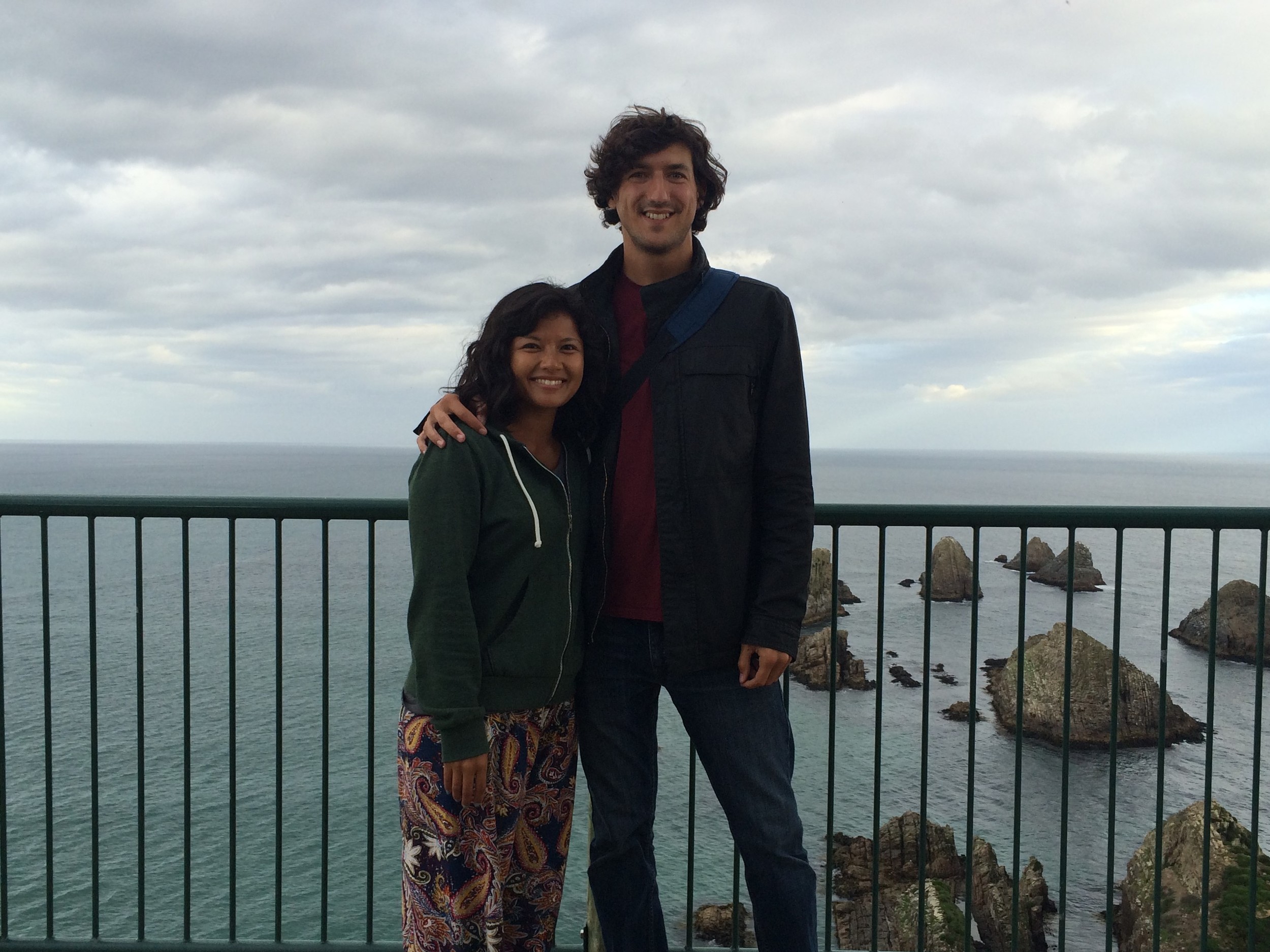
legolas literally stood right. here. 

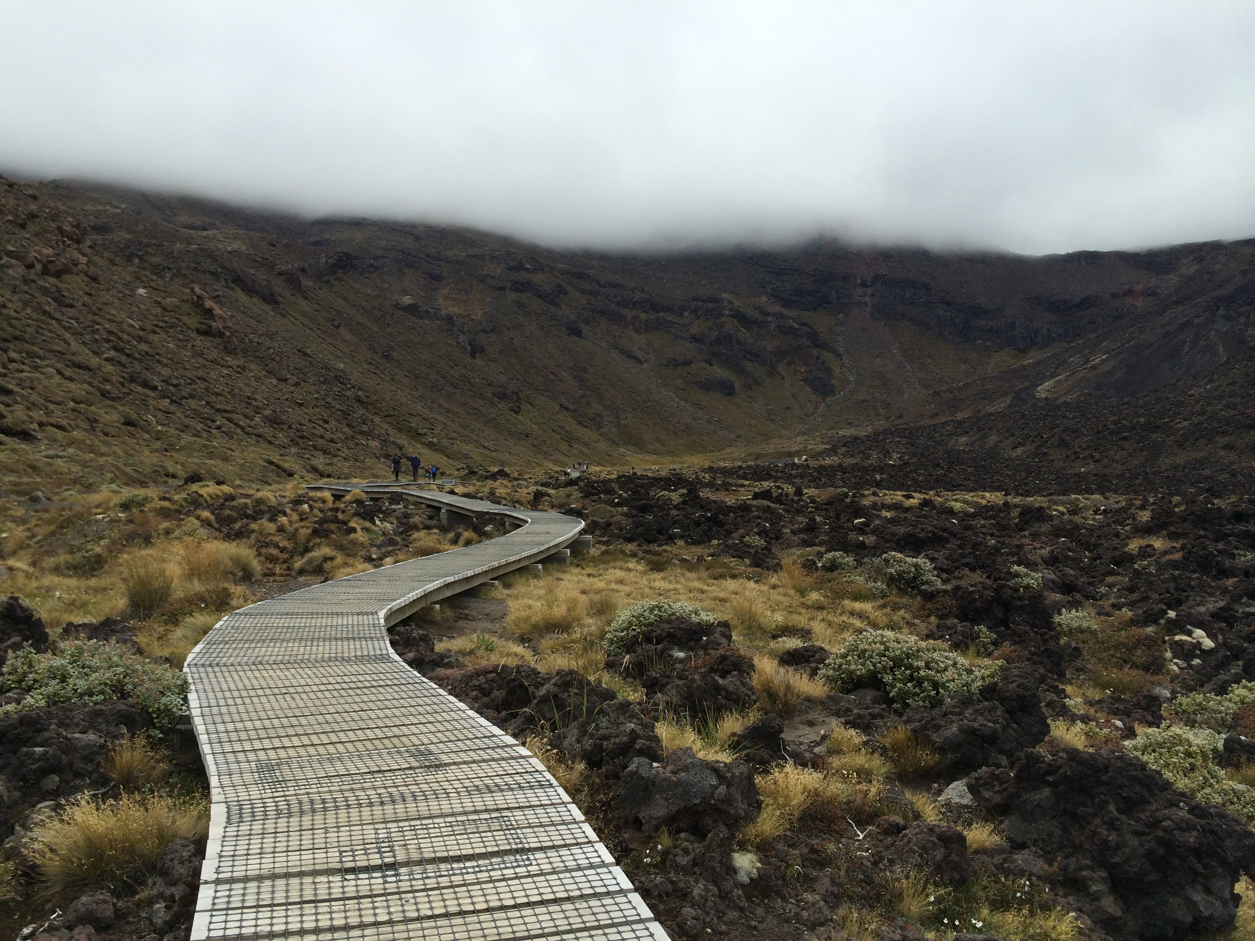
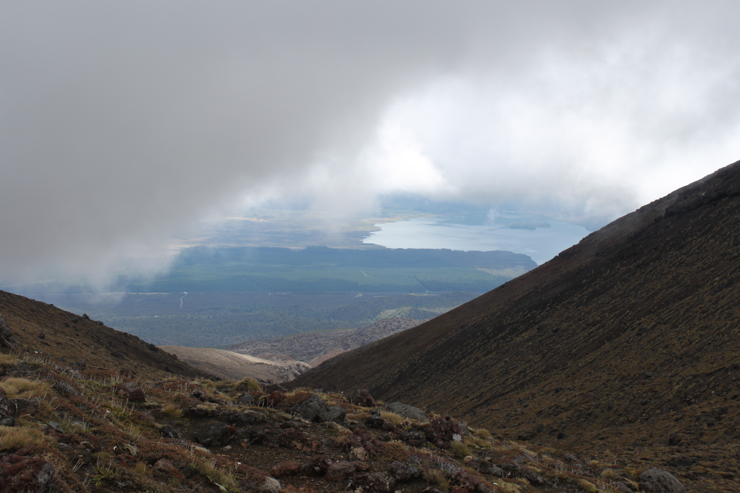
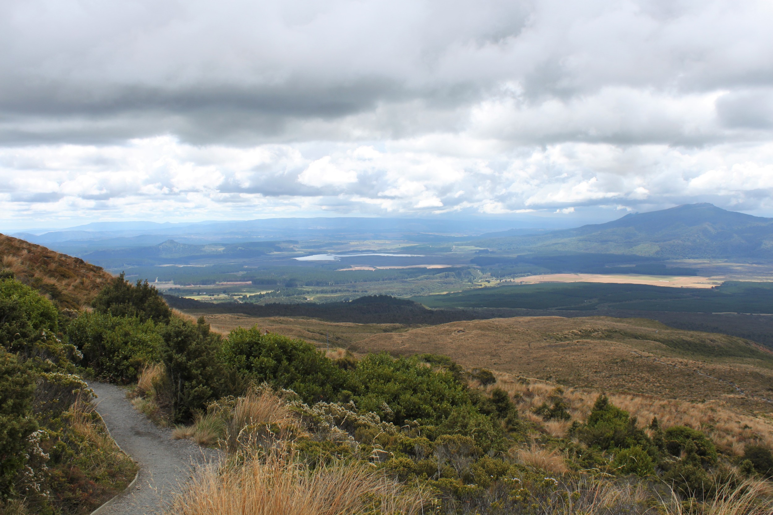
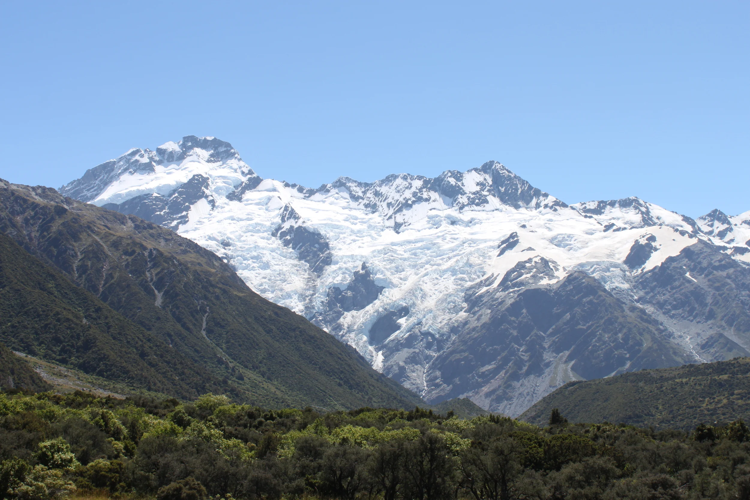
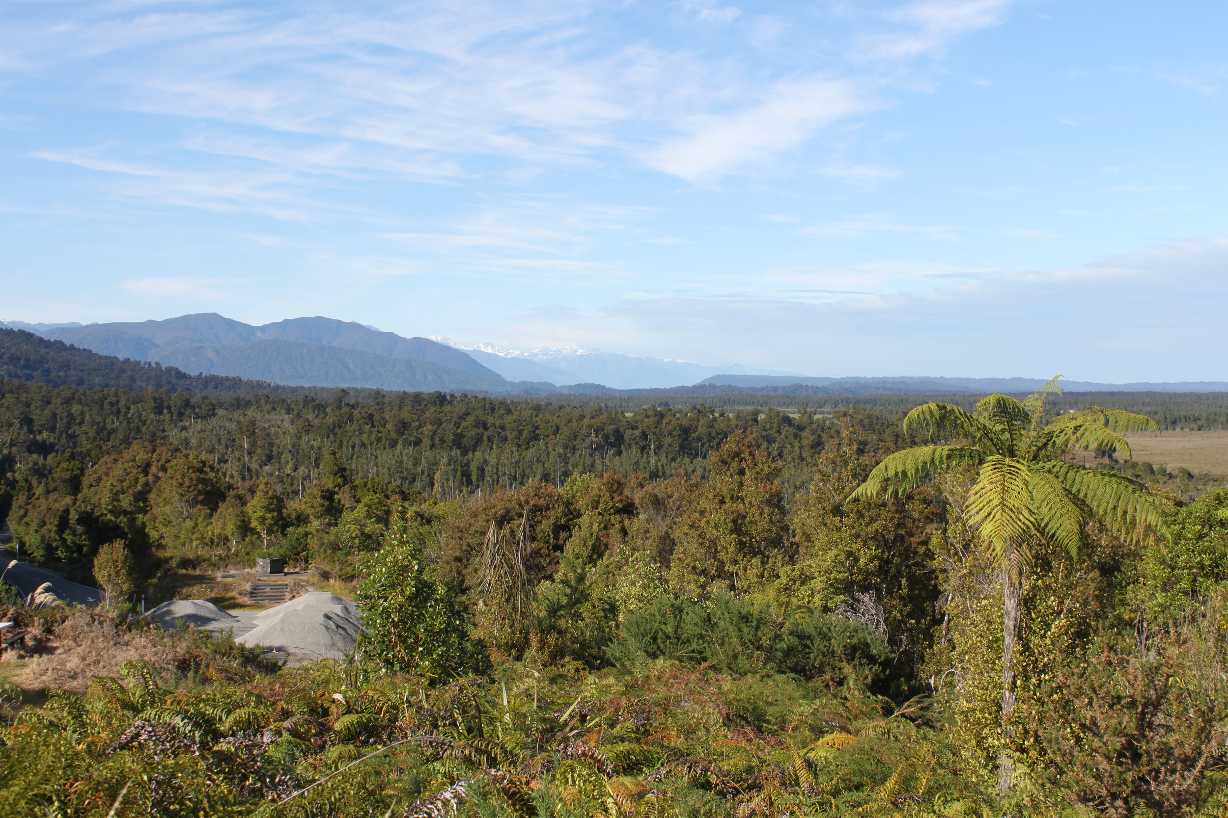
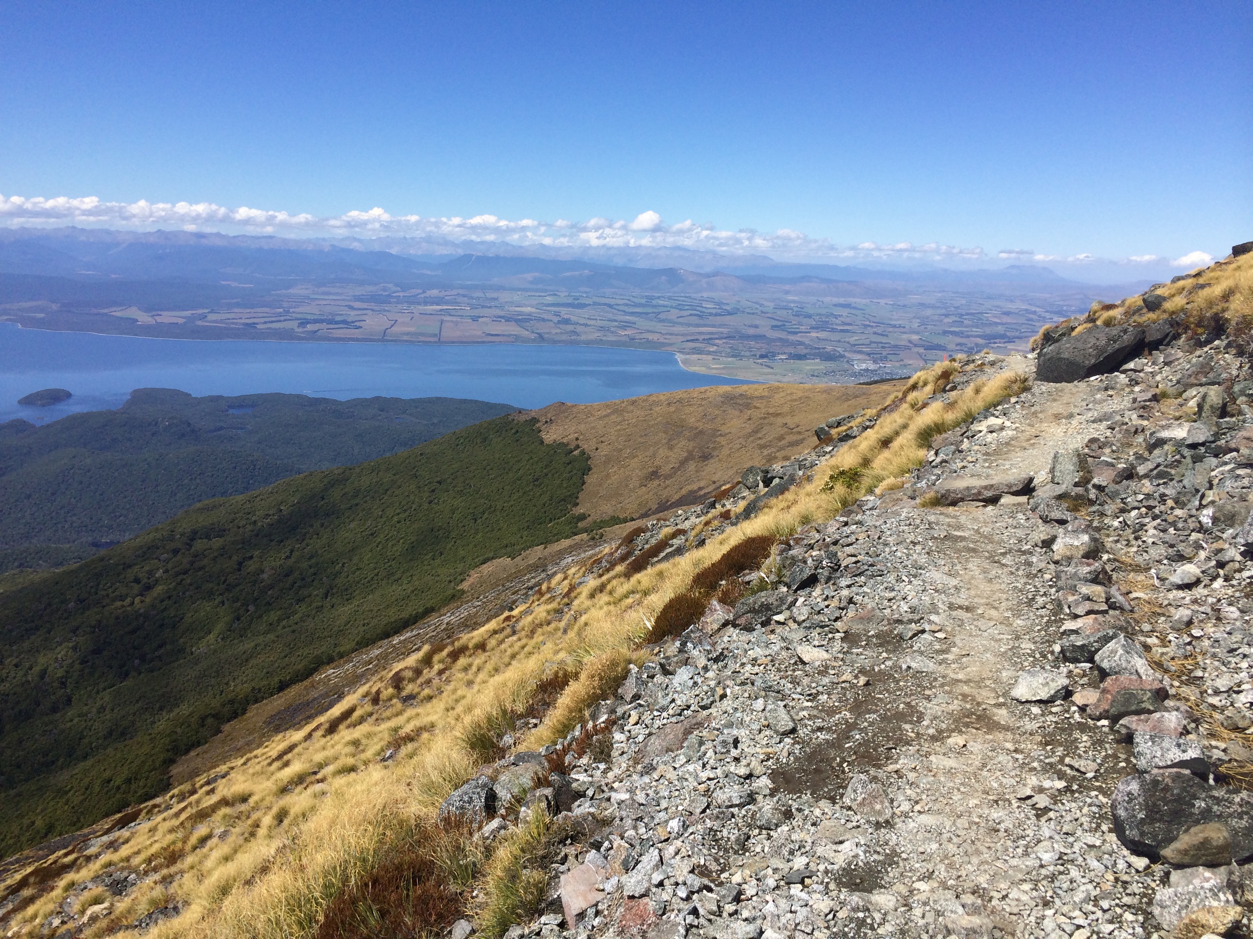
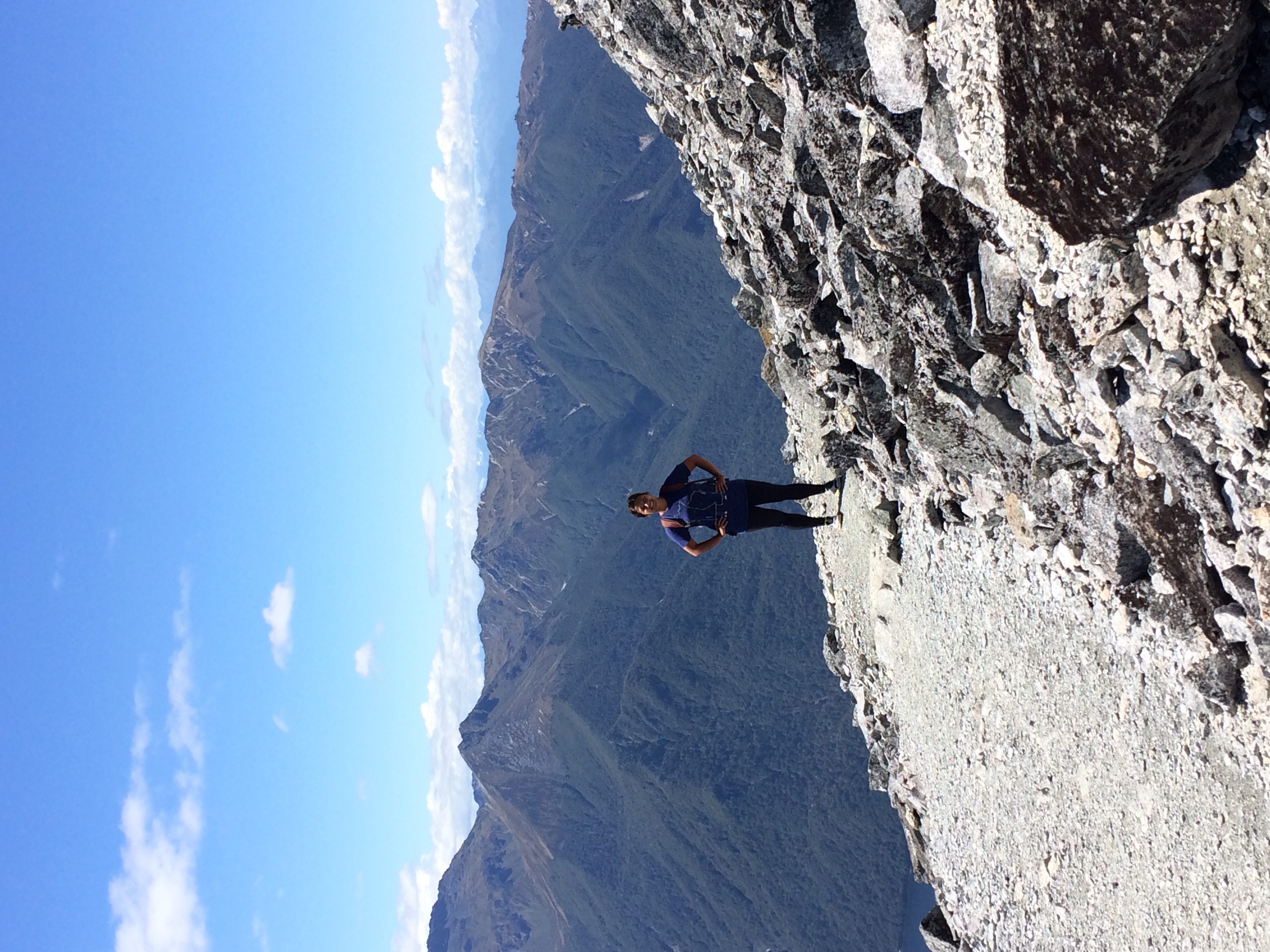
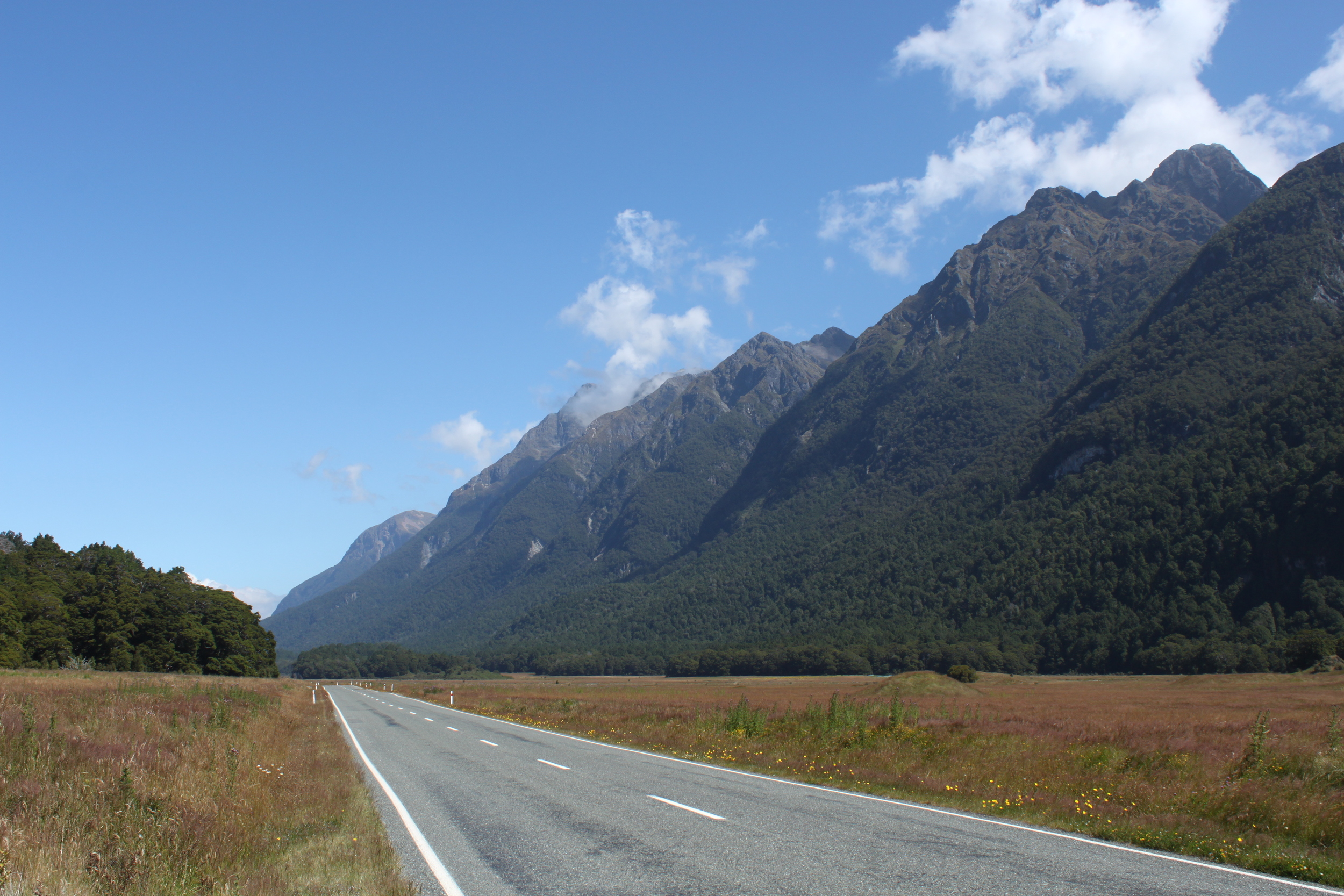
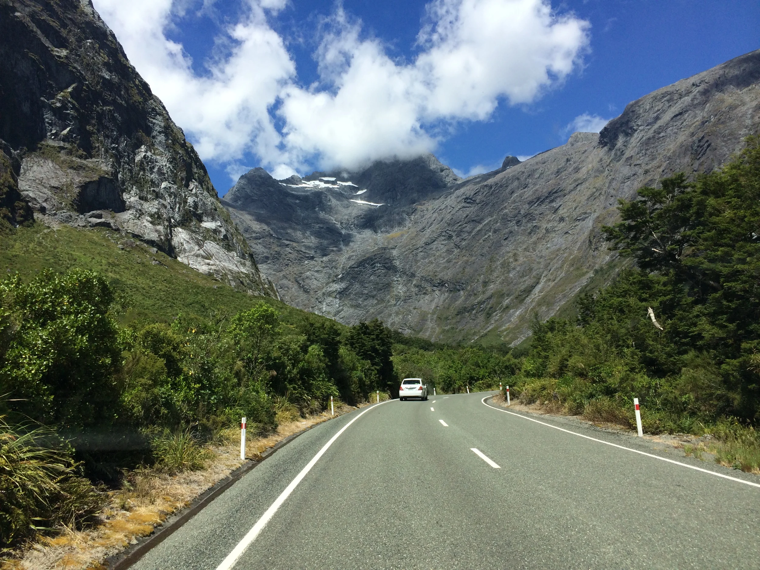
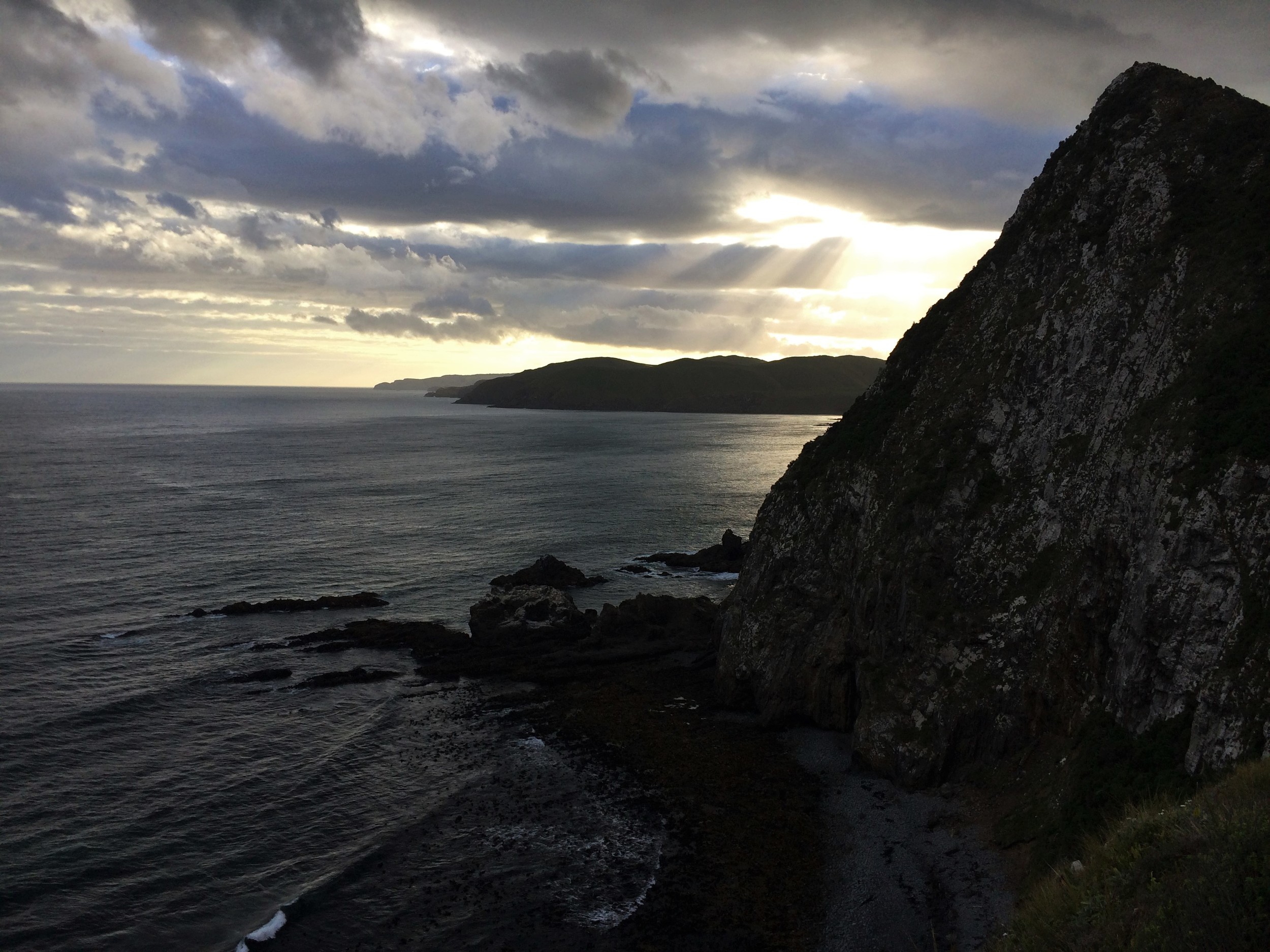
after the fog of our hangovers lifted the next morning, we got a chance to see more of the city. perched on the bay and surrounded by picturesque hillsides, “welly” is a relatively small but beautiful place. there are lots of great bars and restaurants, and the laid-back vibe reminded us a bit of portland and halifax. unfortunately the weather wasn’t on our side, so we decided to hit the road that afternoon. we were hoping to visit hobbiton, but tickets were a whopping $70 each to see the shire. i definitely don’t think frodo would have approved. instead we headed to kaitoke regional park to check out rivendell, the magical home of elrond in the lord of the rings. in other words, i got to giddily prance around the same grassy area legolas (read: orlando bloom) did over ten years ago. definitely a nerd-out moment, for sure. our tour of Middle-earth continued as we ventured further north. the scenic drive confirmed that there really is no place quite like new zealand. when you’re here, you feel like you’re tucked away in a very special corner of the world where seemingly normal things like trees and grass have a sort of whimsical feel. we eventually crossed into the north island volcanic plateau and arrived in tongariro national park, the oldest park in the country. the perfectly conical mount ngauruhoe looms over trekkers as they pass over the tongariro crossing. this was to be the pinnacle of our travels through Middle-earth – hiking around mount doom.

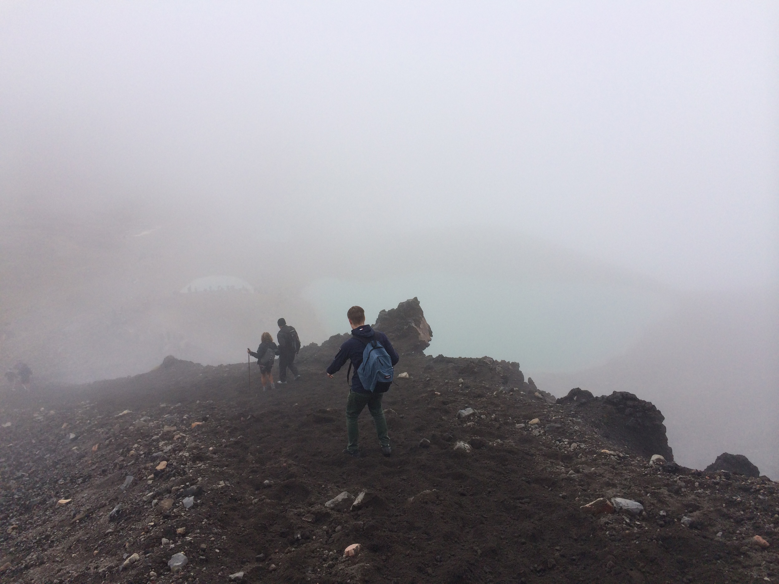
alex hiking into the mist.

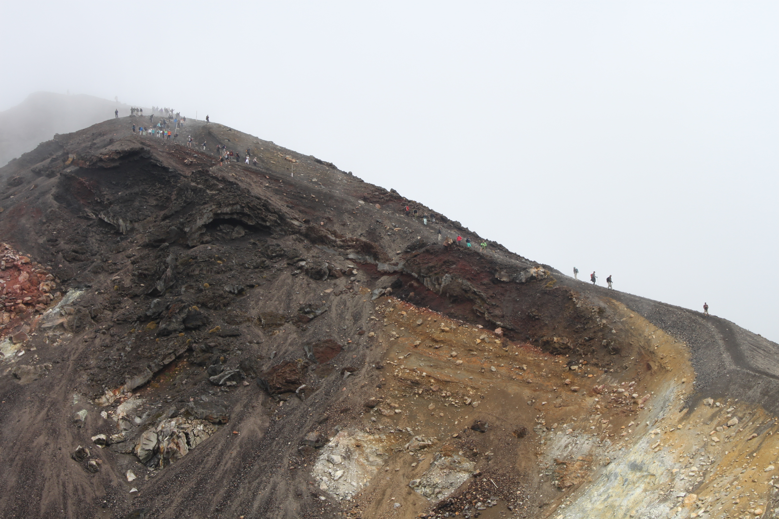
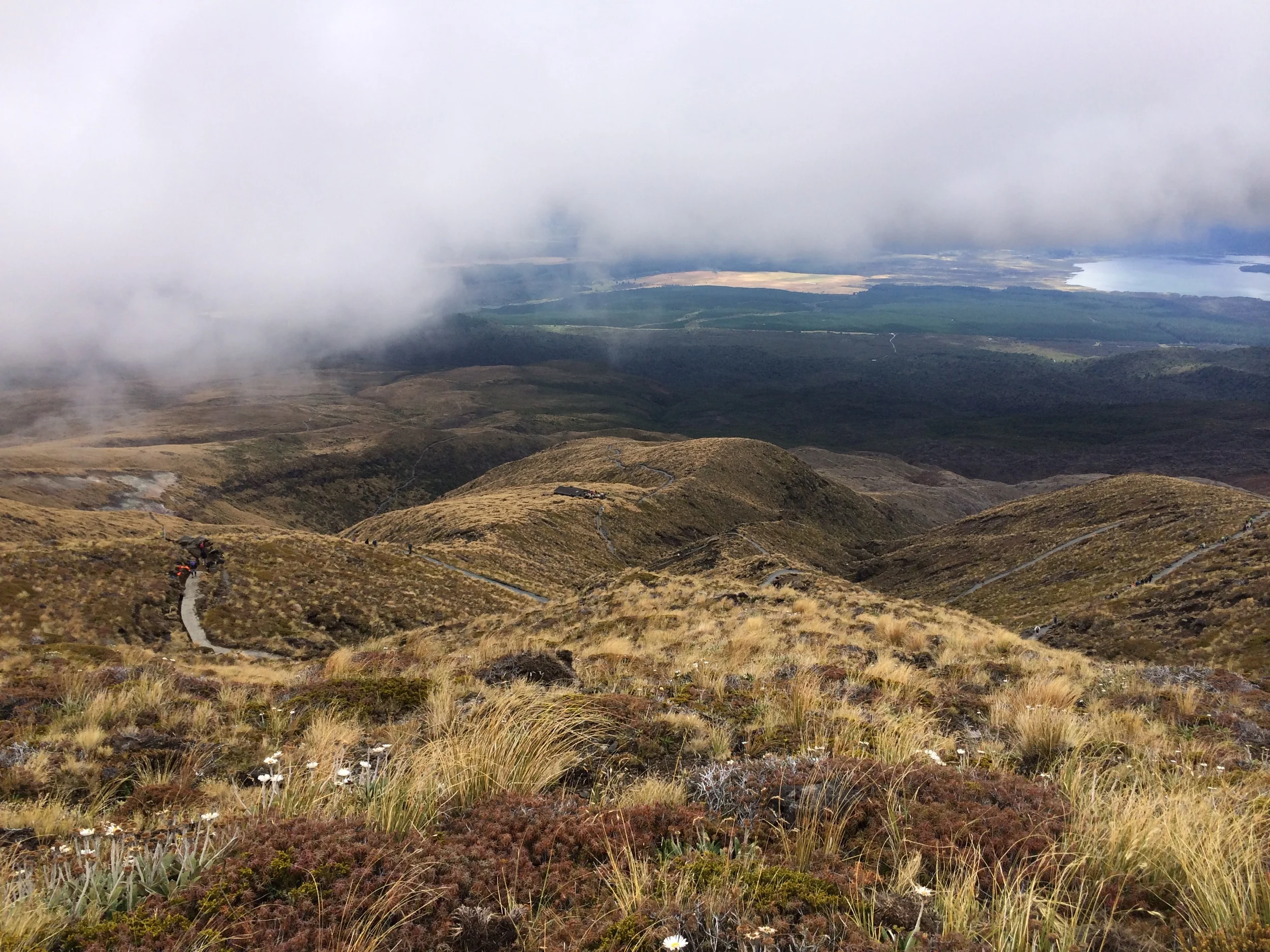
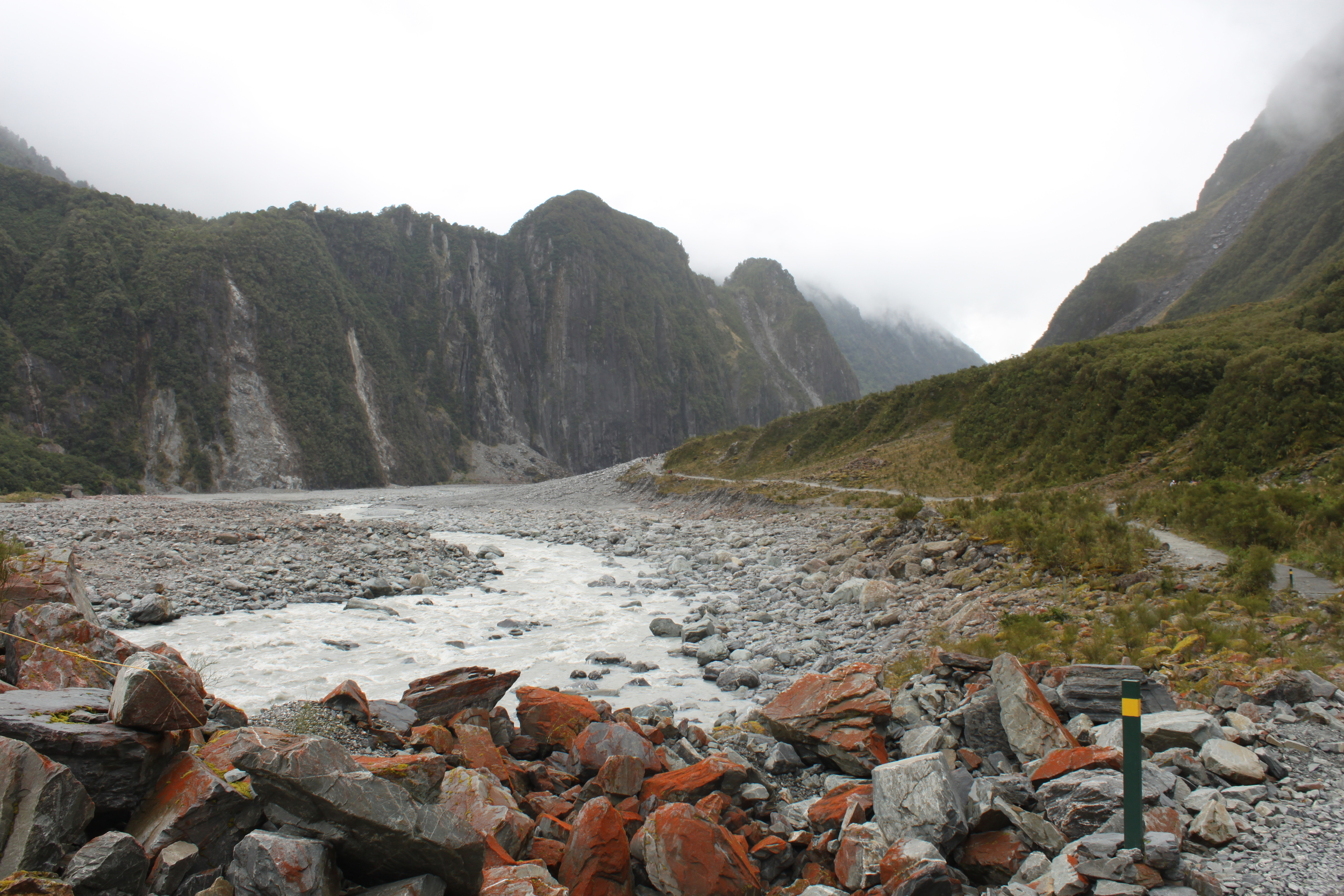
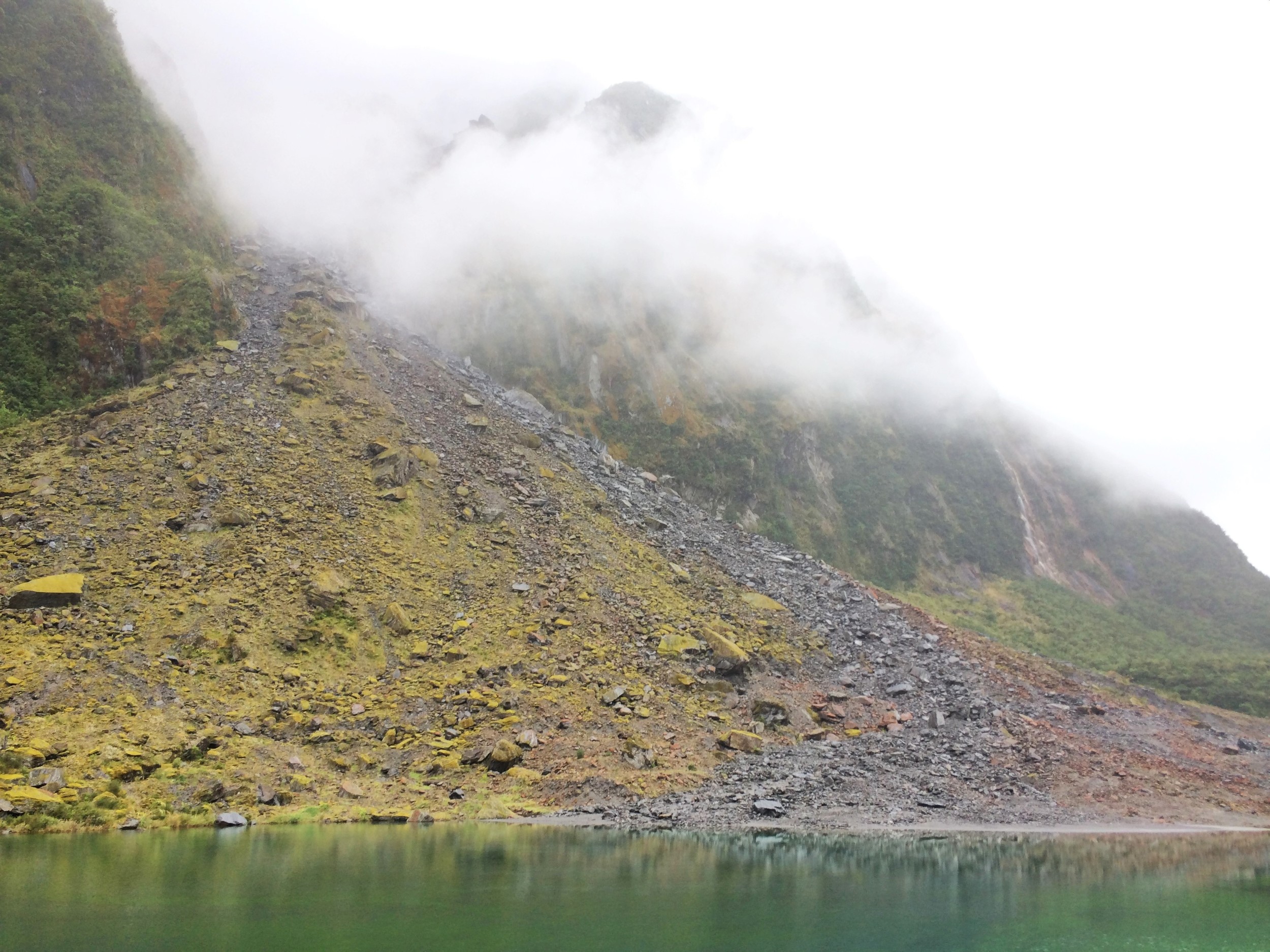
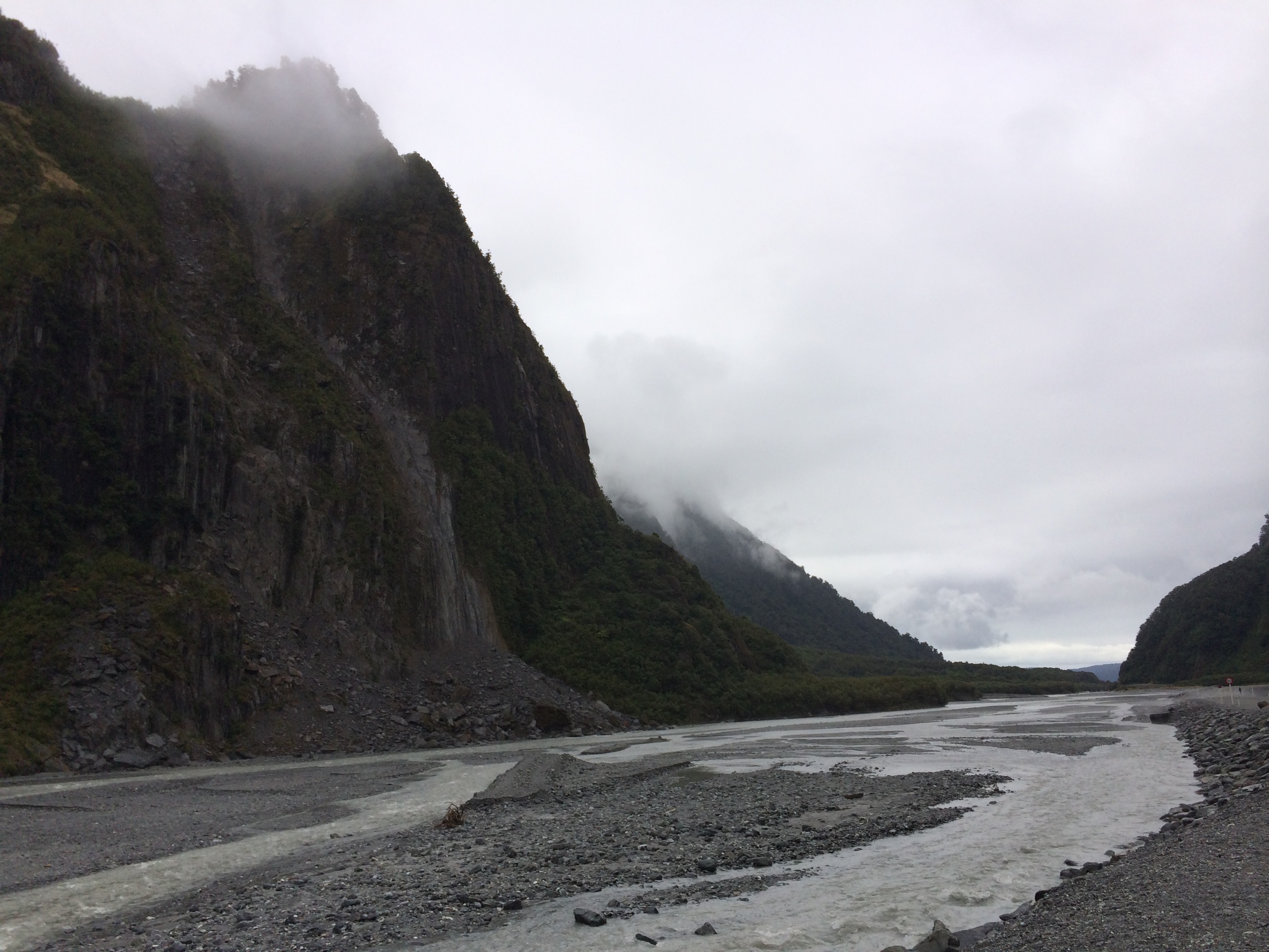
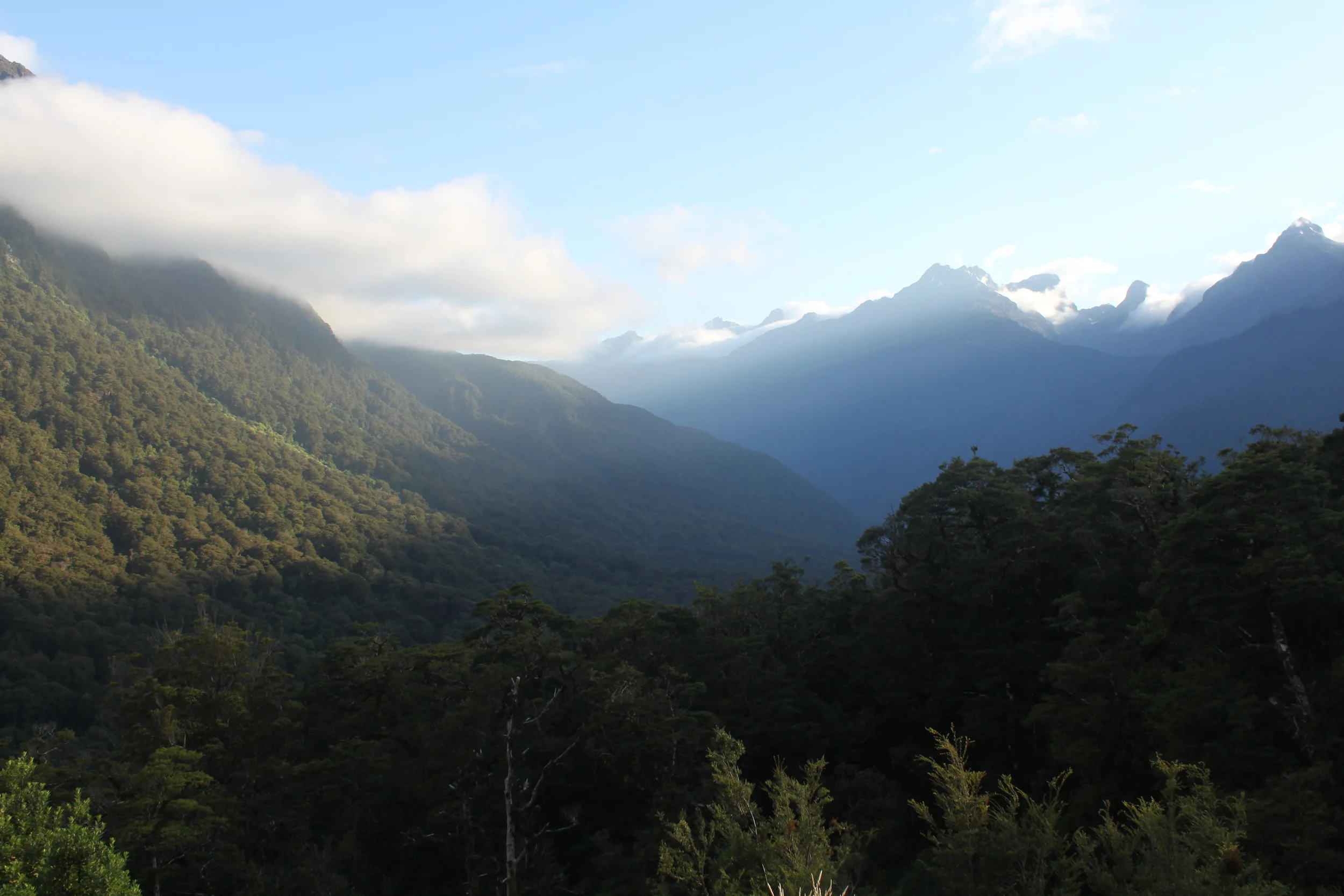
despite the overcast sky and far-from-stellar forecast, alex and i were really excited to do the 12-mile trek. even with the unpredictable weather, we decided to go for it the next day. unfortunately the clouds and fog hid many of the magnificent views throughout our hike – visibility was maybe only 20-30 feet at times. we really were hiking in the clouds! but the steep climb and long journey were still well worth it. the gray stillness that surrounded us was strangely welcoming. tramping along ancient volcanic rock through the mist, it was as if we’d been transported to some remote, otherworldly place.

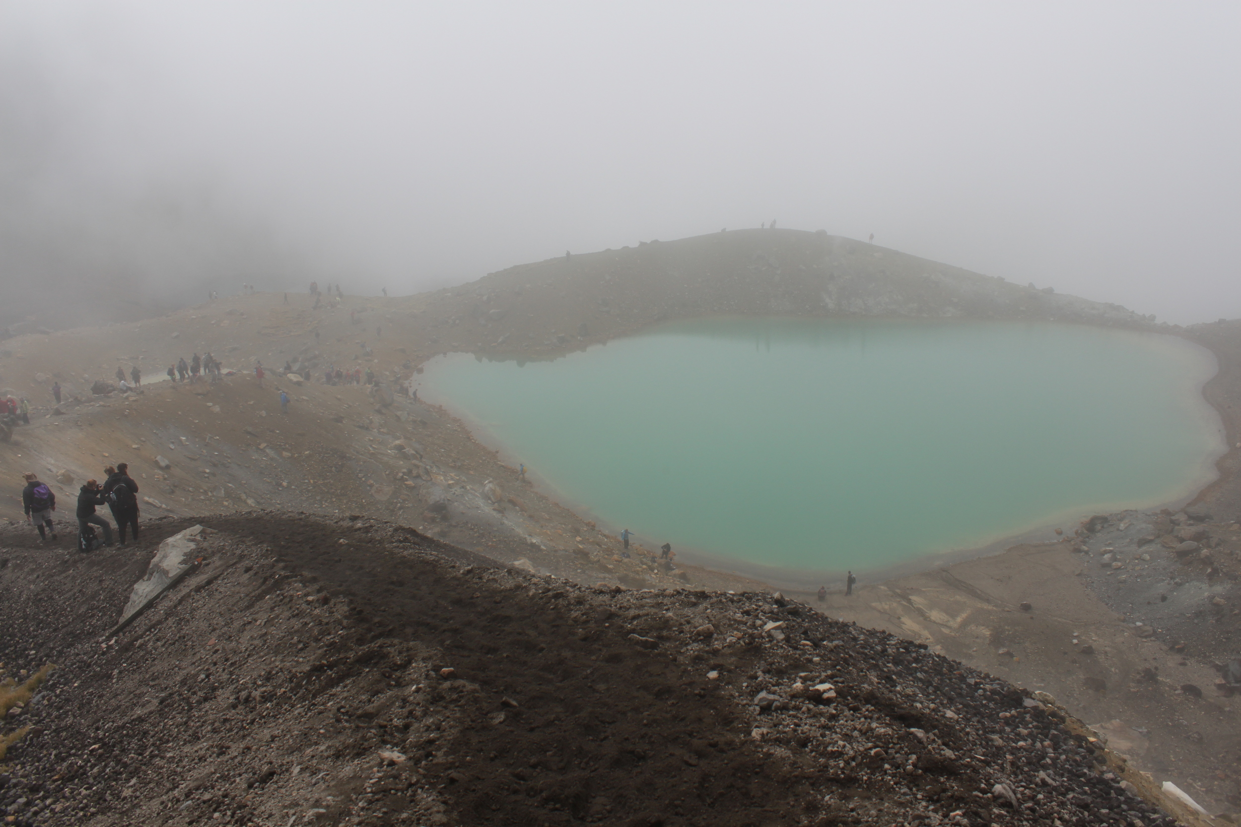
thank you, sunshine! the smelly emerald lakes were so stunning in your presence.

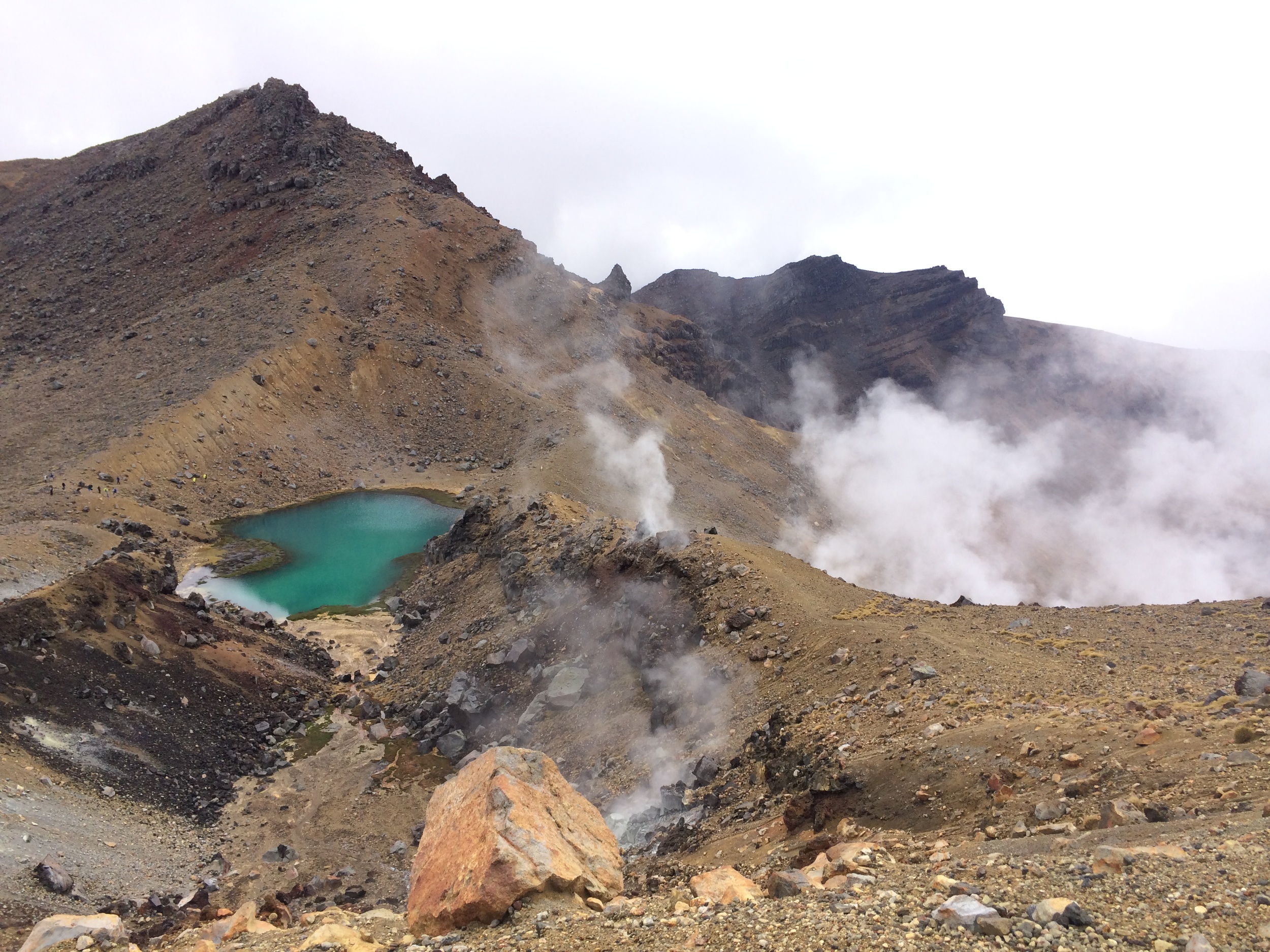
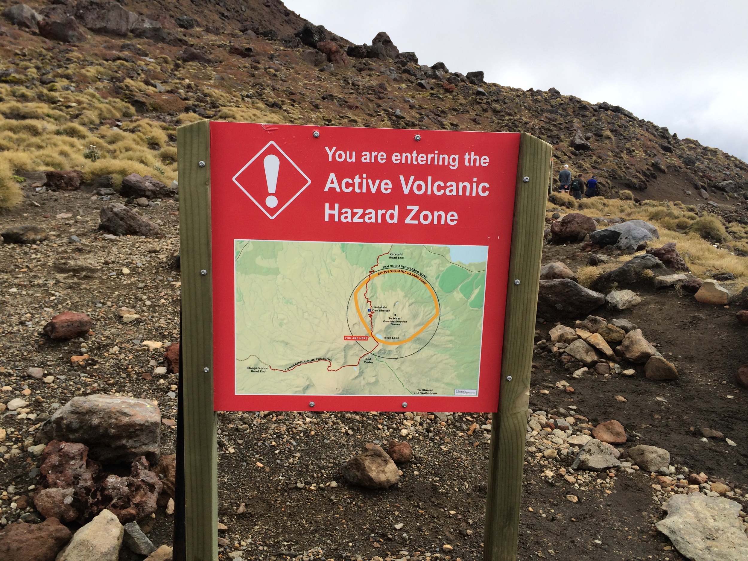
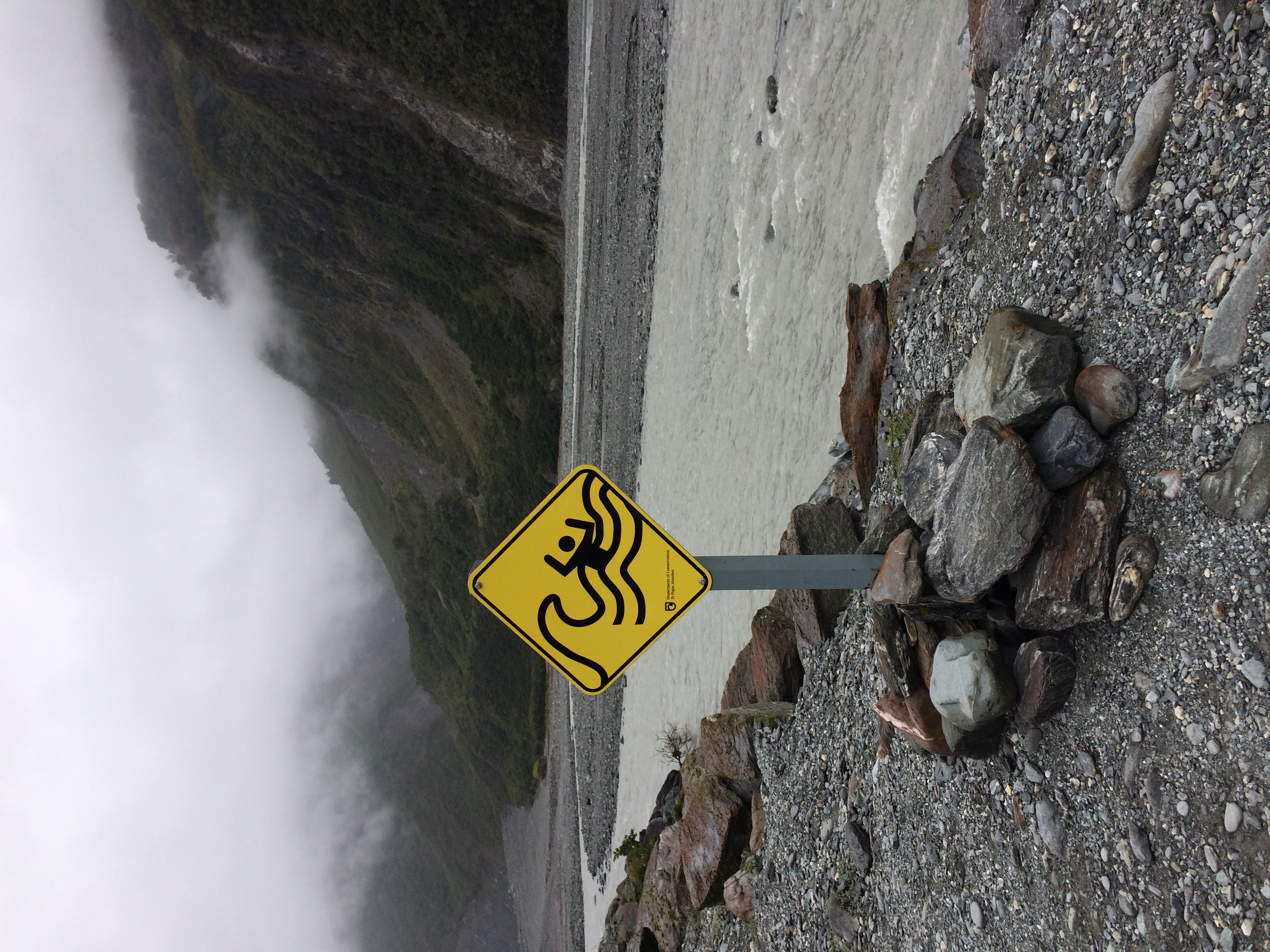
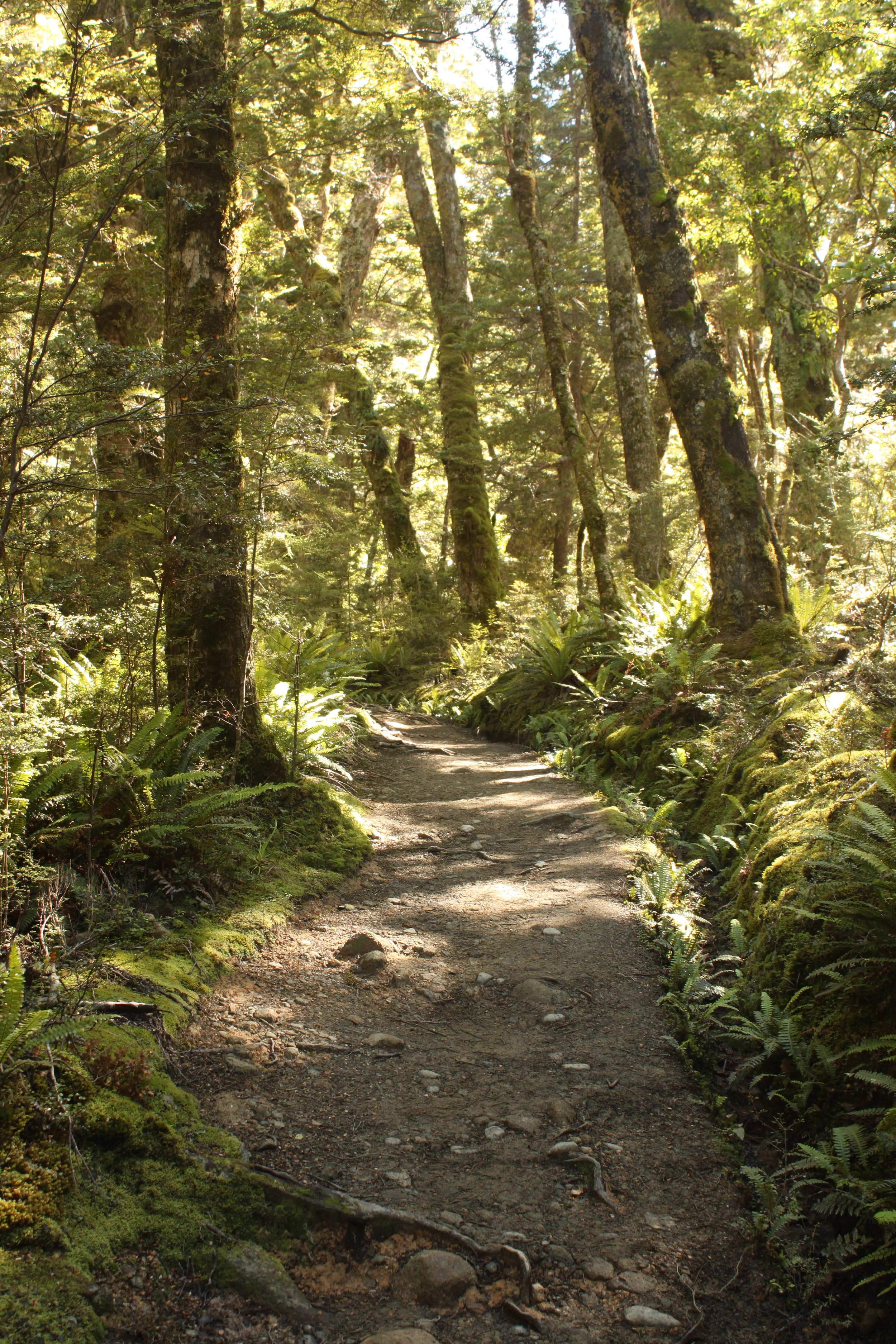
eventually we came to a narrow, exposed ridge where the only way to the bottom was sliding down loose lava rock. at this point we were a bit thankful for the cloud cover…otherwise it would have been ten times more terrifying! at the bottom of the ridge the beautiful emerald lakes came into view, and the less-than-welcome smell of sulfur greeted our noses. as a reward for our patience, the clouds parted for half an hour and revealed the brilliant turquoise hue of the lakes and intensely red color of the crater we’d just hiked down. it was absolutely breathtaking. the hike continued past blue lake and through the active volcanic hazard zone. there have been eruptions here as recently as 2012, and multiple steam vents made the walk through the area a bit thrilling. as we zigzagged our way down to ketetahi hut we saw a helicopter bringing small loads of supplies to construction workers who were repairing the track. our epic trek across magnificent active volcanoes finished with a relaxing walk through leafy green native forest.

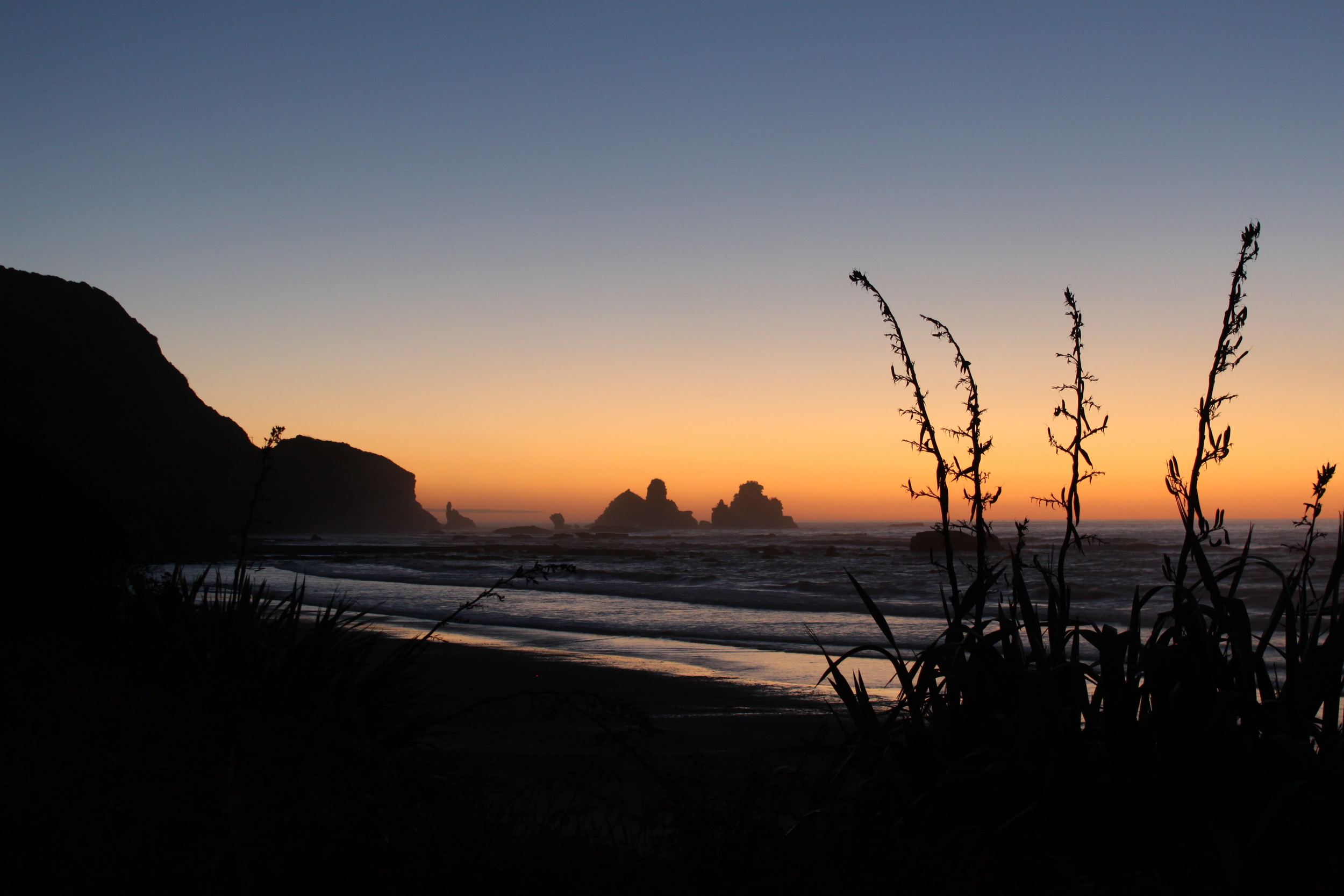
alex and the moon at tuapiro point.

pleased with our day’s work, we spent the rest of the afternoon driving up and around beautiful lake taupo and enjoyed a relaxing night at a hostel near the water. the next morning our wheels were spinning north once again, this time through the thermal valley, where steam rose up in columns around us every few miles. along the way we stopped to check out these huge, boiling-hot mud pools blowing stinky bubbles. the best part of the afternoon was spending a couple of hours at the waikite valley thermal pools. fed by te manaroa spring – the largest single source of 100% pure boiling water in new zealand – the pools are set at different temperatures and framed by pretty countryside and steam coming up from the spring. we eventually peeled ourselves away from the healing waters and drove up to tuapiro point, where we put the car seats down and set up “camp” in the back of our hatchback.  that night we went for a walk along the deserted beach, taking pulls from a bottle of local wine and enjoying the violet, moonlit sky. it was the perfect way to spend our last night of freedom camping.

sitting in our homemade hot tub!

after waking up with cramped necks and stiff backs, we waved goodbye to the horses nearby and continued north to the coromandel peninsula. a local we met in wellington recommended hot water beach, where boiling mineral water surfaces from deep underground and meets the ocean. during low tide, you can see steam coming up from the sand and the water bubbling. there’s nothing quite like grabbing a shovel and digging your own spa right on the beach! we spent our last night at a small, historic inn in the old gold mining town of thames. from there it was a short drive to auckland the next morning. while much of new zealand’s appeal lies in its pristine natural landscapes and impressive glaciers and mountains, it was interesting to see what its largest city was like. wandering among the tall glass buildings, downtown auckland reminded us of a typical mid-sized american city. we drove over to ponsonby, a cute hilltop neighborhood with lots of cafés and hundred-year-old houses overlooking the urban sprawl. apparently the economist ranked auckland as the 9th most liveable city in the world a few years ago, and with its relaxed atmosphere and proximity to so many beautiful natural wonders, it’s easy to see why. it reminded us of san francisco minus the hustle and bustle. after spending our last hour relaxing in the park, we made our way to the airport. three weeks in new zealand wasn't nearly enough time, but we made the most of the time we did have. our road trips across these two incredible islands will always hold a special place in our pretirement memories.

south island, part 3

The last third of our South Island adventure was possibly the furthest from civilization I’ve ever felt. The west coast of the South Island was rushed by gold miners in the mid-19th century and doesn’t seem to have grown much ever since. This part of the island is beautiful, but does not have as many hallmark sights or big towns as the rest of the country. We did without campsite facilities for the first five of our six nights and instead of frantically accomplishing goals (such as the Milford Sound and Mount Luxmore), we spent more time just soaking up the area’s wild beauty. Ever since quitting my job, I felt as if I had been orbiting further and further away from my “normal” life, inertia pulling me away and gravity pulling me back to the USA and what most would call reality every two months. This feeling peaked during these six days. I was far from airports, far even from email, and over a week into a long wander around a huge South Pacific island. Winter was summer, and work meant finding a song to fit the mood or choosing the campsite with the best view. While each moment of the journey may not have provided memories that will last a lifetime, the six days as a whole are something I will never forget.

We woke up bright and early Sunday morning in the middle of the South Island’s dry central plateau with a big day planned. Our goal was to make it to Mount Cook National Park to see the country’s highest point, then backtrack around the park in order to make it over the mountains and to the west coast by nightfall. It turned out to be a little too ambitious, but through no fault of our own.

We first arrived at the southern end of Lake Pukaki in the late morning. This long lake has a spectacular view of Mount Cook over its powdery blue waters—we had never seen anything quite like it. Technically, a person can swim in this glacial lake but having the average body temperature of a deep sea creature is highly recommended. Not surprisingly, Carla wanted to join the teenagers with something to prove while I was content to record her getting in. Anyone who wants to watch a very funny 140 seconds should email me. Much more surprisingly, she was able to convince me to get in when she said I would get used to it after a while. I did not. Very soon afterward we dragged our hypothermic bodies back to the van and set out for Mount Cook National Park.

The valley leading up to Mount Cook.

We warmed up quickly under the bright summer sun and gaped as we drove into the valley leading up to Mount Cook. The twin sights of New Zealand’s tallest mountain and the monstrous white and blue Mueller Glacier looming over the flat, brown valley were breathtaking. When we finally reached the end of the road we hiked an hour to a great lookout point and decided that, yes the whole detour to Mount Cook National Park had been worth it. From what we had seen (or would see) only the Milford Sound could rival the views we’d taken in on this hike. Wishing we had penciled in more time here, we set off late that afternoon on the long six-hour route back south, west and north to the region’s only pass over the mountains. The terrain around Mount Cook was too rugged to support a pass to the west coast.

After a long drive on which we’d pretty much exhausted Bob Dylan’s pre-electric recordings, and then some, we finally made it back to the foothills of the Southern Alps. With about an hour left before sundown we came face-to-face with a roadblock telling us the pass was closed. A little more investigation told us that the region’s only mountain pass had literally fallen off the side of a cliff in a “slip” a few months earlier (nobody was hurt). Luckily for us, the road was in the process of being rebuilt (they let cars through the construction site for several hours each day) and there happened to be an absolutely gorgeous freedom camping site on Lake Wanaka about 20 minutes back. The sunset over the lake was not a bad consolation prize.

Early the next morning we were finally ready to cross over the country’s tallest mountain range. As soon as we were waved through the construction site where the road had fallen down the mountain, the sun was covered by dense clouds and drizzling rain. We later learned that while the land to the east of the mountains is very hot and dry, just on the other side is an actual rainforest complete with exotic plants and a seeming wall of green on either side of the road. Unfortunately this also meant many of our views from the wet, windy road on the way down to the coast were spoiled. The two main attractions on this day were Fox Glacier and Franz Joseph Glacier—two huge masses of ice visible a short hike from the highway. Despite the cold and miserable weather we decided to hike to Fox Glacier and just hoped not to get soaked. Thankfully we did not, and the hike was well worth it. The glacier is 13km long and descends 8,500 feet down the mountain, ending right in front of the viewpoint in an amazing wall of ice just 1,000 feet above sea level. We were not so lucky with Franz Joseph Glacier. A fine, piercingly cold rain fell throughout the next hike and when we arrived at the viewpoint, chilled to the bone, we saw… nothing. In the past 10 years the glacier has retreated at unprecedented speeds and now is hardly visible from the designated viewpoint. Sadly, this is a product of global warming—the current mid-range prediction is that the glacier will retreat by a further 5km by 2100.

After a quick grocery run we got back in the van and went straight north, hoping to find some better weather. Along with a perfect campsite at a beautiful lookout point, that’s exactly what we found. The only thing spoiling our camping experience was the great curse of the South Island’s west coast—sand flies. Along with the rainforest-level moisture come swarms of tiny black bugs not much bigger than a gnat, but much more vicious. Like mosquitoes (there are plenty of those too), they suck human blood and leave lumps that itch for days. However, unlike mosquitoes, where there is one there are a hundred and they don’t just come out around dawn and dusk. Any little trip outside the van could mean five or ten new bites. We went through quite a bit of bug spray over the next few days and still found ourselves scratching away.

The next couple days were spent around the towns of Hokitika and Greymouth, exploring these remote gold rush-era outposts along with their beaches and mountains. In a shrewd bid to boost tourism, the region around Greymouth officially encourages freedom camping and sets up plenty of little flat spots to park for the night, usually complete with a picturesque view. The rest of the country more tolerates it than encourages it. In an otherwise wasted part of town they even set up a free site for campervans complete with fresh water, waste dump facilities and a view of the river. While this might not have been the best part of town (I woke up at 3:30 to hear a drunk screaming alone into the night) it did make our lives a lot easier.

The view from our last freedom camping site.

After a few small walks and hikes we left Greymouth for Paparoa National Park, our northernmost stop on the South Island. This coastal park has some very unique rock formations as well as surge pools and blowholes that shoot water into the air when waves crash against the shore. The power of the waves shooting out of the blowholes was amazing. We spent our last night freedom camping on the coast and caught a perfect sunset over the ocean with silhouetted mountains spilling into the water. Thick swarms of sand flies made sure we watched the sunset from the van’s window but still, it was a perfect end to our drive up the west coast.

The next day we finally started back over the mountains and towards Christchurch. This mountain pass (again, the only one within several hours in either direction) was first blazed by gold prospectors in the mid-1800s with horses and wagons. As we got higher into the mountains we grew more and more amazed that people had pulled wagons over this raw land and actually made it through. The cliffs were steep and the views were dramatic enough to warrant being designated as a national park. As we approached the highest point we stopped at a lookout and were thrilled to see a few rare Kea birds hanging around the parking lot. These are the world’s only alpine parrots and they are only found on New Zealand’s South Island, making the sighting pretty exciting. On the way back down we couldn’t resist one final mountain hike for a proper goodbye to the South Island.

That night we found our last campsite (and first paid campsite with real showers and toilets in six days) just over the mountains. The people here were unbelievably welcoming and when Carla asked if they had movies to rent, the lady in charge went asking around if anyone could lend us a DVD. Fittingly, a very friendly older man who seemed to live in a shack at the site had the full collection of the Lord of the Rings—extended edition. He had one leg, chain smoked, and couldn’t have been happier to help a couple Americans watch the Fellowship of the Ring on their last night in the South Island. It was a great reminder that a visit to New Zealand can be as much about the free-spirited and outgoing culture as the unbelievable natural sights.

The next day we headed to the car rental office with heavy hearts. We only had time for a last homemade lunch on the side of the road, using up as many of our groceries as possible, before making our way to the airport. From the snowcapped mountain vistas to the rocky coastal views, the remote homecooked dinners to the quaint and historic towns, the rewarding hikes to the bottles of wine under the stars, neither of us will ever forget these two weeks. The South Island road trip will always be one of our fondest memories of our year of travel.

Our campsite by Lake Wanaka.

Up close and personal with the Kea.

south island, part 2

our time in the southwest part of south island ended up being three of the best days of our road trip because fiordland national park is just too spectacular for its own good. the largest of new zealand’s fourteen national parks, fiordland is home to some beautiful trails and a wide range of flora and fauna – many of which are completely unique to the area. our new friends gary and susan highly recommended we check out mount luxmore and the kepler track. who knew that the last day of january would be the first time we’d summit a mountain? the challenge promised sweeping views of the te anau basin, and with the skies clear and the sun shining we couldn’t wait to get started.

enjoying a short break at brod bay.

our 20-mile roundtrip hike began with an easy walk near the lakeshore through a thick forest of mountain, red beech, rimu, and miro trees. with every step, it felt like we were heading deeper and deeper into middle-earth. the magical world tolkien had created was coming to life all around us! after passing through a verdant grove of hard tree and crown ferns and crossing a little bridge, we reached beautiful brod bay and stopped to take in the views. at this point the trail began to climb and didn’t stop for a few hours. but we were too busy enjoying our surroundings to be bothered by the ascent. tall trees rose up to meet us in every direction as the path wove its way up the mountainside. beams of sunlight streaming through the canopy made our vivid green world glow even brighter. 

breathtaking views kept us going the whole way.

we eventually reached the sheer limestone bluffs and took a short break. after another hour or so of hiking, we reached the bush line and stepped out into the arms of the warm sun. it’s funny how abruptly the trees ended there, as if they'd made a pact to stay put. with their trunks and branches out of the way and no one around us, we were suddenly aware of the panoramic views we had to ourselves. the te anau basin, the takitimu mountains, and the snowdon and earl mountains were laid out before us in all of their splendor. we arrived at luxmore hut just in time for a quick lunch of peanut butter and banana sandwiches. those who do the entire kepler track (3-4 days) usually spend the first night here, which is less of a hut and more of a large, well-kept cabin. this was originally where we’d planned to turn around because alex was afraid that if we tried to summit, it’d be too late to make it back down before sunset. i, on the other hand, had more faith in our tramping abilities, and we’d actually made it to the hut in less than half the estimated time. hooray! so, after twenty more minutes of relaxing we left our sunny spot on the deck and resumed our journey. 

up, up, up we hiked, past small mirrors of water and golden grass until the top of mount luxmore loomed directly above us. this was the most unnerving part of the trail – you have to tread carefully on gravelly rock right on the mountain’s edge. there were no guardrails to keep us from slipping and sliding a long way down to a very unhappy place. i found this exciting, but being on the edge made alex very on edge. thankfully we made it past this section alive and suddenly found ourselves at the foot of the summit. after a bit of scrambling up some loose rock, we were standing on top of our first mountain at 4,829 feet! looking down, it was hard to believe we’d started all the way at the bottom, just above sea level. the views were incredible, and we were very proud we’d made it. we spent an hour there relaxing and enjoying the scenery, then reluctantly started on our long descent. ten grueling miles later, we were finally back at the start of the trail and totally exhausted. this was by far the longest and most challenging hike we’d done to date, and our bodies were definitely feeling it. but despite complaints from our cramped legs, our eyes were thankful for the breathtaking sights we’d witnessed that day.

the incredible milford sound on a rare sunny morning.

the next morning we woke up early and got ready for our next adventure – a boat ride through milford sound. as we drove along the very scenic milford road, we watched the mountains grow steeper and the greens, grays, and blues intensify around us. it was a beautiful, winding two-hour drive, and our morning was off to a great start. but it was about to get even better. as we’d heard all along, milford sound truly is a spectacular natural wonder. we were lucky enough to experience its beauty on a sunny day, especially since this is one of the wettest places in the world where the mean annual rainfall is a whopping 182 inches!

milford sound is also actually a fjord, not a sound – the difference being that a fjord is carved by a glacier and not a river. the fact that it was created by glaciers hopefully paints a picture of how impressive and awe-inspiring this place is. but i’ll let our pictures do most of the talking. suffice it to say that we loved cruising alongside the green mountains and sharp cliffs decorated with rolling fog. the roaring waterfalls were also incredible, especially since we got close enough for a “glacial facial!” and i definitely got a kick out of the adorable fur seals sunning themselves on the rocks (who wouldn't?).

freedom camping definitely comes with great surprises.

we spent the rest of the day enjoying the pretty drive to lake wakatipu, new zealand’s longest lake. the color of the water was gorgeous – a sort of milky turquoise blue – but it hadn’t always been that way. apparently there’d been a huge landslip a week or two before we arrived, and all of the fallen glacial rock sediment had changed the lake’s color in the best way possible. it was quite mesmerizing! as the sun was setting we settled into drift bay on the southern edge of the lake. it was the perfect place to camp for the night – right on the beach and with a tiny teepee to boot! to complete the ambiance, wispy clouds curled over the peaks around us and glowed with just a hint of sunlight. i think this will always be one of our most memorable camping spots.

after two days of action-packed hiking and sight-seeing, we slowed down the pace for a bit and had a nice, leisurely sunday. we said goodbye to our pretty spot on the beach and made our way along the s-shaped curve of the lake to queenstown. this is the adrenaline junkie capital of new zealand...and arguably the world. everywhere you turn are signs advertising skydiving, bungee jumping, whitewater rafting, hang-gliding, you name it. if it weren’t for alex, i would’ve been suckered into any number of these white-knuckle activities. the prices weren’t exactly pretirement-friendly either, so that was the ultimate game killer. but queenstown is a picturesque place to while away an afternoon, even if you’re not into potentially life-threatening thrills. after a long lunch and a nice stroll around the sun-drenched town, it was time to get back in the campervan and head north towards twizel, a sleepy town just a few miles south of lake wanaka. that night we stayed at a more traditional campground, and i made use of our little camper kitchen and made some panang curry with chicken. twizel also happens to be in a “dark sky reserve”, which meant we got to eat dinner under a blanket of twinkling lights and shooting stars. it was a perfect end to a perfect weekend. then again, every day’s a weekend day for us…

a peek at what life on milford road is like.

south island, part 1

After our short road trip along Australia’s Great Ocean Road, we were excited to begin a much longer road trip in the South Island of New Zealand. Coming from North America, it has always looked like New Zealand and Australia are right next to each other. Of course that is not the case—Christchurch, NZ is 1,500 miles east of Melbourne and our afternoon flight got us into Kiwi-land well after dark. New Zealand really is out in the middle of the South Pacific, away from all other civilization. In our minds, it was always this far-away land that we may or may not ever see because of the time required to get there and get around the island. The freedom to not just go anywhere in the world but to take as much time as we need has been one of the best aspects of taking a full year to travel. All our lives, we had heard from American friends and New Zealand expats alike about the beauty of the South Island. Now we were finally there and we could not wait for the sun to come up.

We stepped out of the hostel Sunday morning onto a dreary Christchurch street. In hopes of finding an internet café where we could plan our route, we headed toward the city center on foot. We had heard about the devastating Christchurch earthquakes of 2010 and 2011, but didn’t expect to find the city still so… devastated. Residential neighborhoods looked normal enough, with some abandoned (probably condemned) houses here and there, but the commercial city center was a true ghost town. An entire office building fell to the ground in 2011, crushing the people inside, but most of the other high-rises in the city of 350,000 are dying a slower death. Multi-building complexes are entirely fenced off, shattered glass still sits in windowpanes, and some small retail centers still have all of their dusty, fading signs up despite empty shelves. The city’s 19th century cathedral still sits in shambles, waiting for the wrecking ball. What started out that morning as a disappointment soon became a fascinating (but sad) lesson of what a major earthquake can do to a city. We learned that many victims have moved out of Christchurch for good, heading south to Dunedin or Queenstown or north to Nelson or the North Island. Locals complain that the rebuilding process has been slowed by countless lawsuits and government red tape, and the fact remains that the city center has a long ways to go before it is even back to empty lots ready for new construction.

We continued west toward Hagley Park and the Botanic Gardens, the city’s outdoor centerpiece. Thankfully the earthquakes did not affect this low-rise neighborhood as badly, and here Christchurch looks more like a normal city. The park itself is a perfect symbol for a country that prides itself on its natural beauty. There are gardens with fantastic flowers, wide open spaces for concerts and ancient Ent-like trees towering over the landscaped paths. This was the Christchurch we were looking for. A nearby museum café served as a perfect base to spend a few hours planning before I caught a bus to the car rental area.

We had booked a “campervan” (that’s what they are called here) for 14 days and nights. We figured this would be enough time to see what we needed to see in the South Island before spending our last week in the smaller North Island. Due to an error on the part of the rental company, we ended up with a bigger campervan than we expected. This was both a blessing and a curse. It was of course more comfortable as our home for two weeks but if it were much bigger I think I would have needed a special driver’s license. Navigating this new city on the left side of the road, hoping my back tires were following the front was a little more stressful than your average day of pretirement. Despite this, it had all worked out. I got the van on time, picked up our luggage from the hostel, didn’t get lost, had a full tank of gas and was almost to the street corner where Carla was waiting for me to start our adventure. Then disaster struck. Or at least I thought it did. I went over a bump and immediately heard that sickening grinding noise that means you’re done driving for the day. Something had fallen out of the bottom of the (almost brand new) campervan and was sparking along the street while I pulled over. I got out to see gallons upon gallons of fluid literally gushing out of the car and along the gutter. My first instinct was to imagine a giant fireball engulfing the sidewalk where I stood but then I stuck my fingers in the fluid and smelled nothing but water. The campervan’s huge water tank—there is literally a bathroom with a shower in the van—had fallen out of the bottom of the vehicle before we’d even left the city.

false start.

A long powerwalk over to where Carla was waiting (and wondering), a phone call placed at the tourist info center, a tow truck and a couple hours later we were back at the car rental company for a second time. The task at hand was now planning our second night in Christchurch. Our biggest fear was that there were no more campervans available on the spot, being the height of summer, and our entire trip around the South Island would have a very different look. I thought that based on the way this one literally fell apart, there was no way it was a quick fix. Luckily for us, the mechanic said this was a common problem (really??) and he would have it fixed that same night. At least it happened before we got out of the range of tow trucks… I guess. Rather than spring for another expensive hostel, we decided to have our first night of “freedom camping” (sleeping in the van wherever you feel like it) right in the rental car company’s parking lot. This exotic location of natural wonders set the bar pretty high for our final 13 nights in the campervan.

Bright and early the next morning, we were finally off. We decided to head south along the east coast, for no particular reason. There is a long stretch of road to the south of Christchurch that is pretty flat, making it better for farming than sightseeing. However, even this is beautiful with the light blue coast to the east and towering snowcapped mountains to the west. We stopped for our first homemade lunch of smoked salmon sandwiches in the middle of an empty field along the coast. When we stepped out of the van, we finally had that feeling of pure freedom that attracts so many people to New Zealand. We were alone on an anonymous beach in the middle of the South Pacific, carrying all we needed with us, and with enough time to do whatever we wanted in the next two weeks.

wide open spaces and campervan keys.

That afternoon we saw our first natural curiosity—the Moeraki boulders on Koekohe Beach. These near-perfect spheres were naturally formed and now sit on the beach like they were placed there for decoration, giving the beach an otherworldly feel that could be the basis for a Dali painting. As we got further south, there were more forested hills than fields and sheep pastures became a common sight. When we crested the taller hills we were greeted with the pastoral landscapes New Zealand is famous for. Later we pulled into Dunedin, a beautiful college town nestled on the steep coastal hillsides. This old gold mining town, once the capital of New Zealand, immediately won us over with its charming 19th century buildings, hilly coastal views and friendly people. Or maybe I just like it because the name sounds like it was dreamed up by J.R.R. Tolkien.

After cashing in on some half price pizza and beer we headed east to our campsite. Our first night of staying in a real campground brought some challenges (how do I back this bus into the in the parking stall in the dark?), annoyances (they sell wifi access by the megabyte?) and a pretty cool surprise the next morning. The couple parked next to us was sitting out having breakfast and after hearing their American accents we soon started chatting. Gary and Susan were retired New Englanders who love the outdoors and enjoy freedom about as much as we do. For now they had turned their backs on the comfortable life in New Hampshire and instead bought a small van in New Zealand to call home for a while. After maybe three hours of talking at the picnic table that sunny Tuesday morning we all felt very close, and we are still in touch. It is always refreshing to meet successful, intelligent people who have been around a lot longer than us and still come to the same conclusion:  life is too short to be comfortable for too long.

It was lunchtime by the time we left the campsite, so we headed back into Dunedin to see what was on the menu. There are a surprising number of ethnic restaurants throughout New Zealand—even the small towns will almost always have Indian, Thai, Chinese, and plenty of other food that is not meat pies. Larger cities like Dunedin made us feel like we were right back in the East Village. We stopped in for some Cambodian food in preparation for mostly eating out of our little refrigerator for the next couple weeks. It was a beautiful day, which is somewhat rare in New Zealand (the Maori call it “the land of the long white cloud”). Finally ready to enjoy the weather, we kept hugging the east coast on the way to the southernmost tip of New Zealand. Along the way, we stopped at a stunning beach with a seemingly endless white sandbar framed by rolling hills on both sides. There was a lone fisherman on the beach casting his line into the shallow water. We spent some time just walking around this vast, empty sandbar, feeling the same kind of freedom we’d first felt the day before in the wide open field.

After several more hours of hilly views and curvy roads, we found ourselves near a well-known lookout point. It was an 8 kilometer drive down a very bumpy gravel road to get there, but we had time and we thought we might even be able to find our first freedom camping site in this unpopulated area. Driving the last stretch to Nugget Point, we kept pointing at flat-looking spots near the road, weighing the pros and cons of spending the night in each one. At the lookout point itself we were treated to spectacular evening views of the jagged coastline in both directions, as well as the several giant “nuggets” of rock out in the water. As a bonus, there was a large group of seals relaxing on the rocks below and sometimes settling disputes with a noisy fight. On the way back down from the lookout point, we came across another path to a beach where penguins could sometimes be found. I was about ready to find a place to park for the night, but Carla insisted on taking a look. It’s a good thing we did, because we caught a peek at a lone yellow-eyed penguin, the rarest in the world, just standing on the rocks. Only about 4,000 of these penguins exist today and this is one of the few places where they can consistently be found. We were finally able to put my zoom lens to good use.

The view from our window on our first night freedom camping.

Luckily for us, the early February sun stays up until 9 pm this far south. We still had just enough time to pull into the best freedom camping site we had seen, right between the beach and the rolling pastures. This was the perfect opportunity to really use our kitchen for the first time. We turned on the propane and Carla made a delicious dinner of grilled salami and cheese sandwiches with bowls of tomato soup. We washed it all down with a bottle of Australian red wine. With the ocean waves crashing in the background and the sky covered in a dome of stars, we both felt like we were in paradise.

We woke up on Wednesday morning to cereal, coffee and a beautiful view out of our “bedroom” windows. There was a small forest reserve nearby with a relaxing hiking trail that we wandered through before heading west. After a few more hours of scenic driving the land flattened out and we arrived in Invercargill, the southernmost city in New Zealand (and probably the eastern hemisphere). We had heard that this small port town is better skipped, and we heard right. For whatever reason, this was the opposite of beautiful, cheerful and friendly Dunedin. We quickly restocked the refrigerator and bolted for the long, flat farmlands to the north. Our destination that night was Te Anau, the gateway to the famous Fiordland National Park. This park is home to some of the most beautiful scenery in the world, including sheer mountains, deep fjords and the Milford Sound. We found a paid campsite with a view of the mountains that rise so suddenly out of Lake Te Anau, and had dinner watching a storm roll in over the mountains. We slept that night, warm in our campervan, listening to the rainfall and looking forward to going into Fiordland the next day.